Road Trip Pacific Coast - USA
Discussion
Hi all, potentially considering doing a road trip from Los Angeles all the way up to Seattle in three weeks time using the coast roads up until Portland. However, reconsidering it now as the Oregon portion may be raining every day and thus defeating the object of taking it in the first place. Also time is a factor. Flight would land into LAX at 19:00 on a Saturday and then would be flying back out of LAX two weeks later on the Sunday. Thinking it might be better to just do a coast run from Los Angeles to San Francisco. Then head to the grand canyon from here, couple of days in Las Vegas and then either San Diego and up to Los Angeles, or just go directly to Los Angeles from Vegas.
Any tips or recommendations appreciated.
Any tips or recommendations appreciated.
You will miss the best part of the Pacific Coast between LA and San Francisco, BigSur, as there is a long term closure.
https://www.bigsurcalifornia.org/highway_condition...
Detour inland means either missing 80 odd mikes of coast or down 60 miles from the top then back.
I cycled it last year and enjoyed very low traffic I was able to get through the closed part with my bike.
This time of year staying south is better IMO. Better temps, more sunshine, slightly longer days.
I drove from SF to LA a couple of weeks ago - got as far as the Bixby Bridge in Carmel before turning round and driving an hour back to Monterey as the road was closed at Big Sur and hit Highway 101 for about a hundred miles and stayed overnight in Cambria. Then drove the rest of the way on PCH the next day, stopping off in Pismo Beach and Santa Barbara before reaching LA.
The drive through Yosemite is stunninh if the road is still open. Getting close to winter. Current conditions (closed) at
https://www.nps.gov/yose/planyourvisit/conditions....
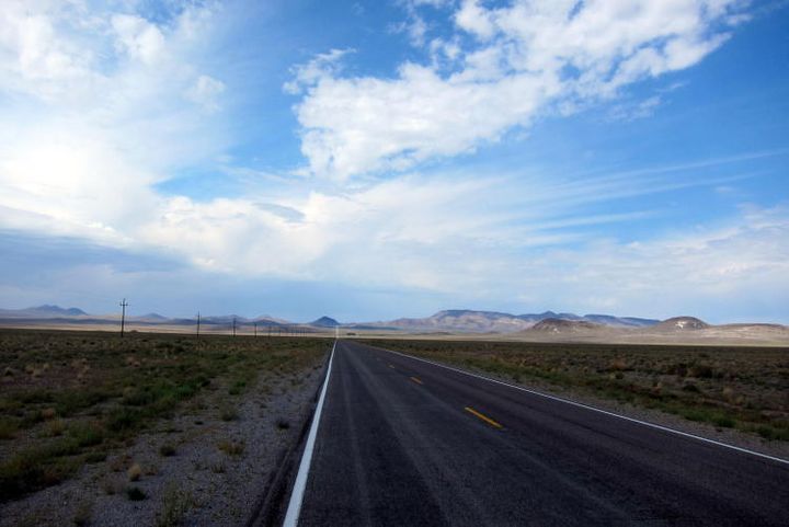
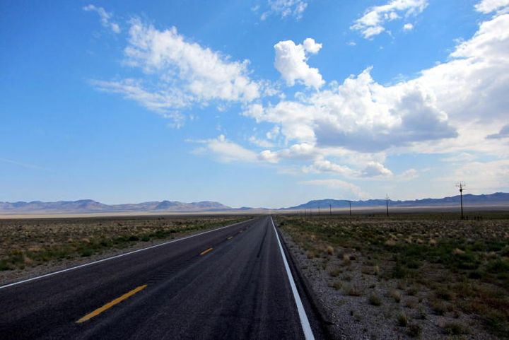
If you like remote empty roads a good option after driving through Yosemite is to Tonopah the Ely. There is bugger all between Tonopah and Ely 170 miles. Long open roads. Often you can see 5 miles each way with no traffic. From Ely you can head for any of the National Parks north of Vegas. Bryce Canyon. Zion. Arches.
FRom Arches you could go south to Monument Valley then drive along the south rim of the Grand Canyon before heading to Vegas.
When I cycled Tonopah to Ely I stopped for pics halfway across a basin. Roughly 7 miles each way. No cars in sight. I love the USA south west.
Edited by irc on Tuesday 29th October 20:43
Edited by irc on Tuesday 29th October 20:44
irc said:
You will miss the best part of the Pacific Coast between LA and San Francisco, BigSur, as there is a long term closure.
https://www.bigsurcalifornia.org/highway_condition...
Detour inland means either missing 80 odd mikes of coast or down 60 miles from the top then back.
I cycled it last year and enjoyed very low traffic I was able to get through the closed part with my bike.
This time of year staying south is better IMO. Better temps, more sunshine, slightly longer days.
I had read about this when I've started to do some research and also when I was plotting potential routes on Google maps, it was making massive detours inland. Then I saw the no entry signs on it for road closures.https://www.bigsurcalifornia.org/highway_condition...
Detour inland means either missing 80 odd mikes of coast or down 60 miles from the top then back.
I cycled it last year and enjoyed very low traffic I was able to get through the closed part with my bike.
This time of year staying south is better IMO. Better temps, more sunshine, slightly longer days.
Pincher said:
I drove from SF to LA a couple of weeks ago - got as far as the Bixby Bridge in Carmel before turning round and driving an hour back to Monterey as the road was closed at Big Sur and hit Highway 101 for about a hundred miles and stayed overnight in Cambria. Then drove the rest of the way on PCH the next day, stopping off in Pismo Beach and Santa Barbara before reaching LA.
Where there are warning sign that the road ahead was going to be closed. Monterey sounds nice. I was thinking of driving straight from LA and staying one night there, before heading to San Francisco. How long did it take you and did you encounter much traffic.irc said:
The drive through Yosemite is stunninh if the road is still open. Getting close to winter. Current conditions (closed) at
https://www.nps.gov/yose/planyourvisit/conditions....
If you like remote empty roads a good option after driving through Yosemite is to Tonopah the Ely. There is bugger all between Tonopah and Ely 170 miles. Long open roads. Often you can see 5 miles each way with no traffic. From Ely you can head for any of the National Parks north of Vegas. Bryce Canyon. Zion. Arches.
FRom Arches you could go south to Monument Valley then drive along the south rim of the Grand Canyon before heading to Vegas.
When I cycled Tonopah to Ely I stopped for pics halfway across a basin. Roughly 7 miles each way. No cars in sight. I love the USA south west.


Well I'll be driving in a 4 series, so will limit my winter driving. Considering going to South Lake Tahoe after San Francisco, but if it is snowing, then snow chains are required, which is a no no for a hire car.https://www.nps.gov/yose/planyourvisit/conditions....
If you like remote empty roads a good option after driving through Yosemite is to Tonopah the Ely. There is bugger all between Tonopah and Ely 170 miles. Long open roads. Often you can see 5 miles each way with no traffic. From Ely you can head for any of the National Parks north of Vegas. Bryce Canyon. Zion. Arches.
FRom Arches you could go south to Monument Valley then drive along the south rim of the Grand Canyon before heading to Vegas.
When I cycled Tonopah to Ely I stopped for pics halfway across a basin. Roughly 7 miles each way. No cars in sight. I love the USA south west.
Edited by irc on Tuesday 29th October 20:43
Edited by irc on Tuesday 29th October 20:44
NSNO said:
Where there are warning sign that the road ahead was going to be closed. Monterey sounds nice. I was thinking of driving straight from LA and staying one night there, before heading to San Francisco. How long did it take you and did you encounter much traffic.
We already knew that there was little point going further than BIxby Creek Bridge - just went there for the photo opportunity really. Left SF about 9:30am and got to our overnight stop in Cambria at about 6pm. Obviously, we would have been there probably 2-3 hours earlier if we hadn’t gone down to the bridge and then doubled back and headed down the 101. As I said, we also detoured into Monterey itself as well, which added some time.
Cambria to LA was another leisurely drive with a couple of decent stops in Pismo for coffee, Santa Barbara for lunch and Pacific Palisades just outside LA for the view - think we rolled up to our apartment around 5pm probably?
We undoubtedly missed a good chunk of the PCH but driving it, however much you can do, is something you definitely have on your list.
I don’t really know how much actual difference it makes but we drove north to south, so that we were on the right side of the road (literally and figuratively) to enjoy the coastline a bit better.
Gassing Station | Roads | Top of Page | What's New | My Stuff


