An eye-opening trip through the US SouthWest megadrought
Discussion


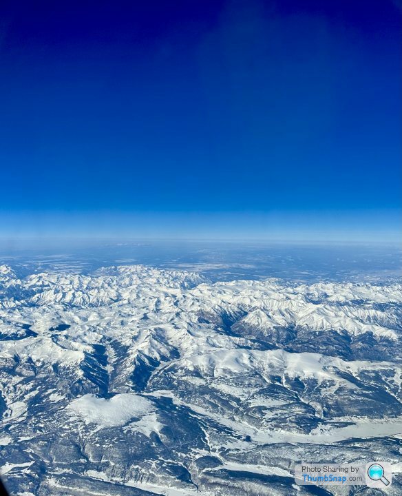
As the plane was on initial approach into Phoenix, the Rockies were clear and the snowpack reflected the bright sunlight. This is the source for the great rivers such as the Colorado that are the vital providers of water to the US southwest. Millions of people are dependent on these river systems.
.
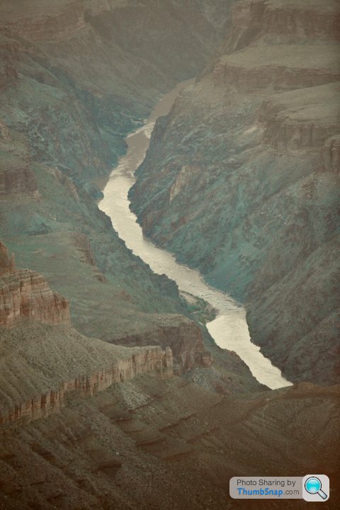
Since the thirties a series of dams and aqueducts provide water to Colorado, New Mexico, Utah and in particular to the desert regions of Arizona and Southern California. Standing at the edge the Grand Canyon you can look down a mile deep and still see the huge Colorado river on its was down to the meet the Hoover Dam and Lake Mead ,the largest reservior in the US.
 .
.
The have been endless articles about the megadrought in the region with its failing water supply, forest fires and the flash floods that cause erosion. The water table is falling steadily and the ability to deep wells is failing.
I had not given a lot of thought to this over the years beyond reading about it.
This is a record of a couple of trips that I found quite eye opening, including one in particular in the last few days.
.
Since the thirties a series of dams and aqueducts provide water to Colorado, New Mexico, Utah and in particular to the desert regions of Arizona and Southern California. Standing at the edge the Grand Canyon you can look down a mile deep and still see the huge Colorado river on its was down to the meet the Hoover Dam and Lake Mead ,the largest reservior in the US.
.The have been endless articles about the megadrought in the region with its failing water supply, forest fires and the flash floods that cause erosion. The water table is falling steadily and the ability to deep wells is failing.
I had not given a lot of thought to this over the years beyond reading about it.
This is a record of a couple of trips that I found quite eye opening, including one in particular in the last few days.
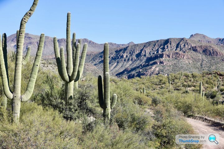
Like much of the SouthWest Arizona is a natural desert, and the native flora and fauna are very well adapted. Everyone associates the Saguaro cactus with the state. They are wondrous things - when the monsoon rains come, a mature Saguaro can absorb one ton of water immediately so that the accordion pleats on the plant expand. They can live for over 100 years.
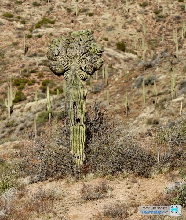
This year I came across the rarest of the rare, a Crested Saguaro. These are mutations that occur once very 200,000 plants. This one was very old.
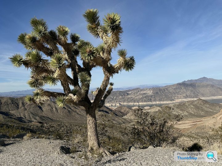
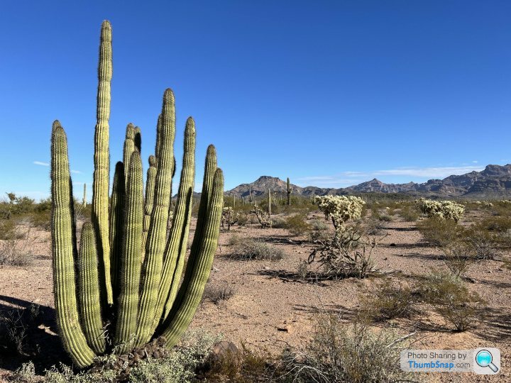
The state has many varieties of desert plants, from Joshua Trees to Organ pipe cactus down near Mexico, both massive when mature.
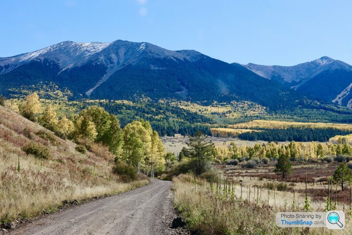
Up in the mountains there are pines and magnificent Aspen that depend on the runoffs from the snowpacks.
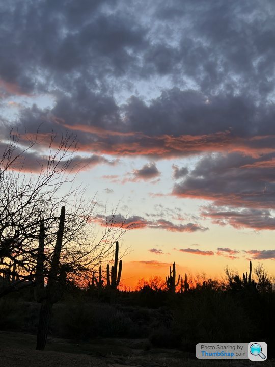
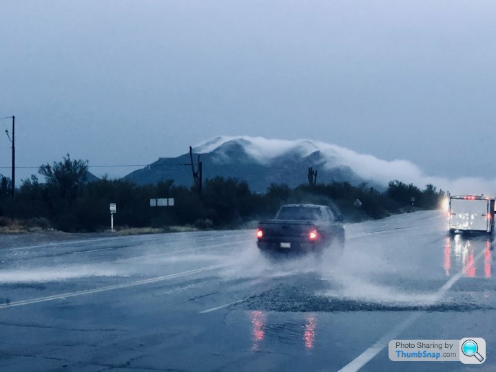
When the rare rains come they are often torrential, wth immediate flash floods, especially in built up areas.

In normal circumstance this all works quite well. The desert continues as it has forever.
These are not normal circumstances as the most precious of resources is beginning to run out.
Water.
By far the largest consumer of water is agriculture.
Water is controlled be a series of dams and aqueducts that have harnessed every major river.
Small remote towns in AZ and California have existed by drilling deep wells. This wells are at their maximum depth now and it is beginning to require water to be trucked in.
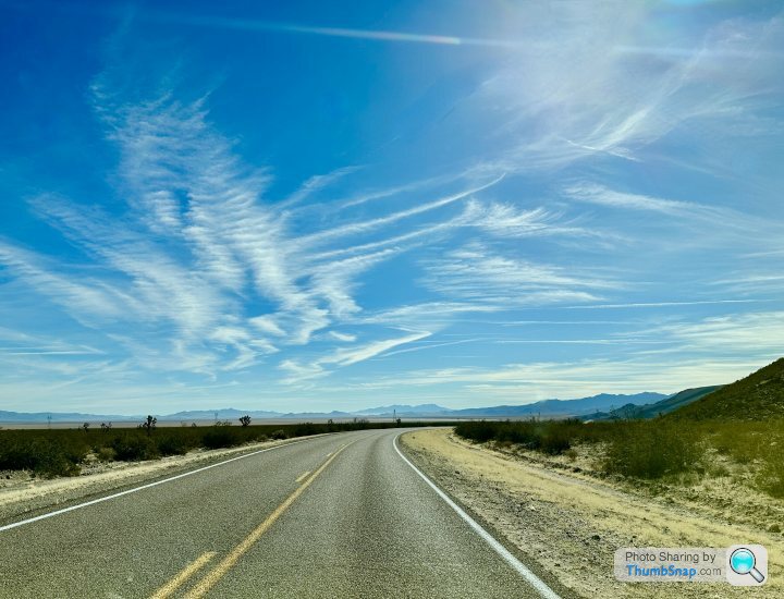
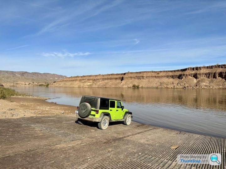
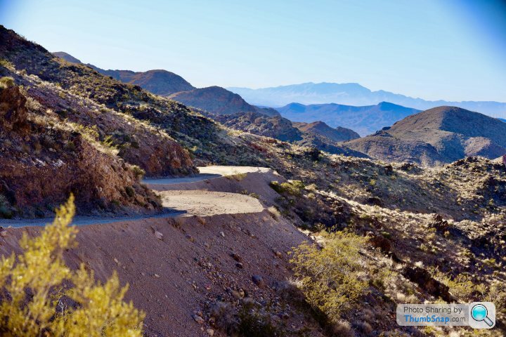
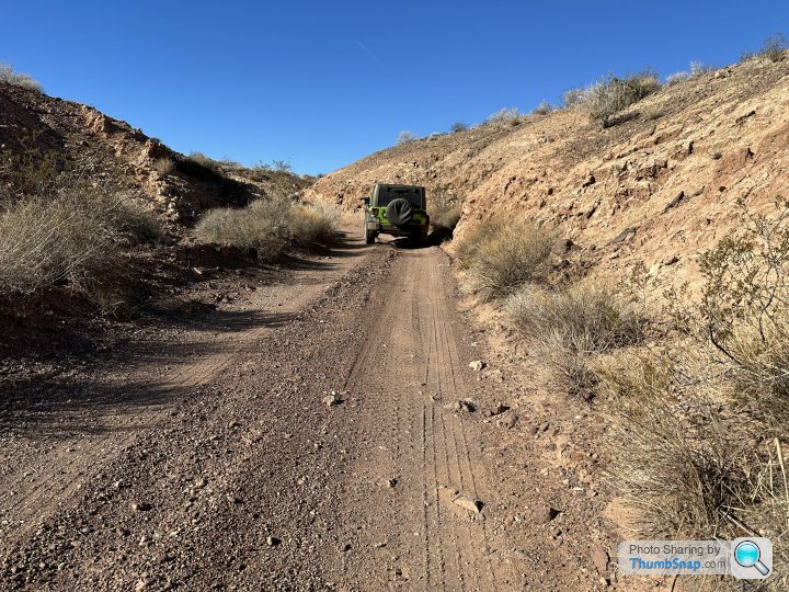
I have always loved the endless open roads and off road trails of the SouthWest. It is very common for car commercials to be shot here. The clear air, cloudless skies and sparse population outside of the cities makes for memorable driving..
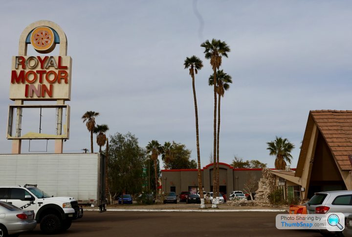
Downstate in Scottsdale everything is as normal these day with no real evidence of drought. Scottsdale has city water. However,smaller communities are beginning to experience cost increases and shortages.
This year I came across the rarest of the rare, a Crested Saguaro. These are mutations that occur once very 200,000 plants. This one was very old.
The state has many varieties of desert plants, from Joshua Trees to Organ pipe cactus down near Mexico, both massive when mature.
Up in the mountains there are pines and magnificent Aspen that depend on the runoffs from the snowpacks.
When the rare rains come they are often torrential, wth immediate flash floods, especially in built up areas.
In normal circumstance this all works quite well. The desert continues as it has forever.
These are not normal circumstances as the most precious of resources is beginning to run out.
Water.
By far the largest consumer of water is agriculture.
Water is controlled be a series of dams and aqueducts that have harnessed every major river.
Small remote towns in AZ and California have existed by drilling deep wells. This wells are at their maximum depth now and it is beginning to require water to be trucked in.
I have always loved the endless open roads and off road trails of the SouthWest. It is very common for car commercials to be shot here. The clear air, cloudless skies and sparse population outside of the cities makes for memorable driving..
Downstate in Scottsdale everything is as normal these day with no real evidence of drought. Scottsdale has city water. However,smaller communities are beginning to experience cost increases and shortages.
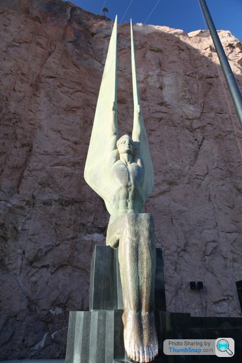
A trip up to the Hoover Dam seemed like it would be interesting.
This brought me to the Arizona-Nevada border.
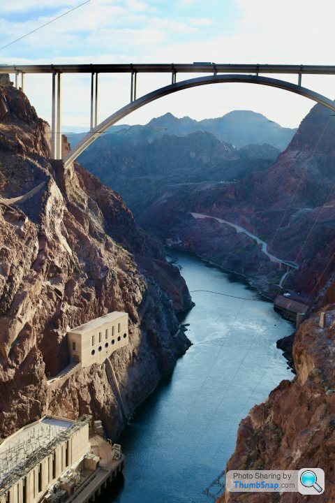
Here sits the spectacular dam, a magnificent engineering feat.
 |https://thumbsnap.com/vYH2DQYj[/url]
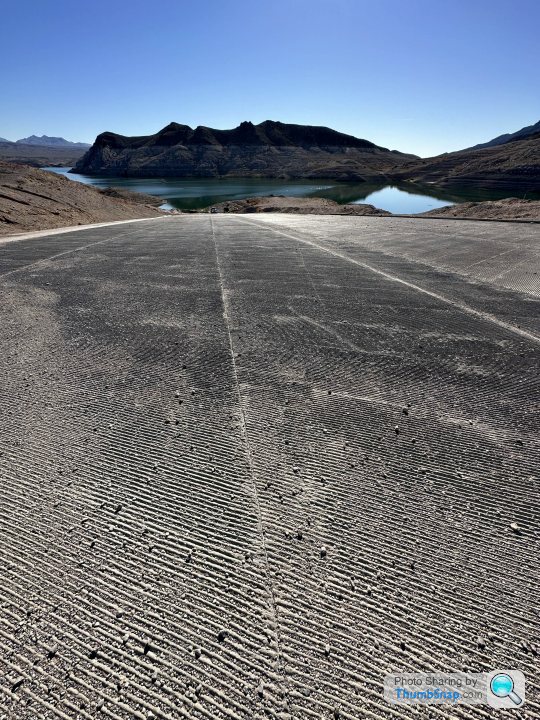
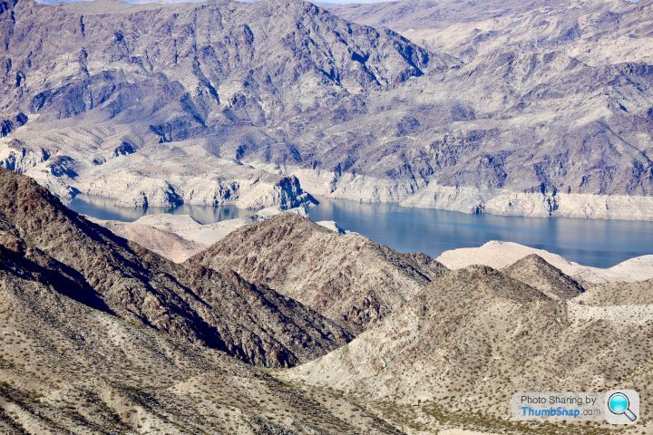
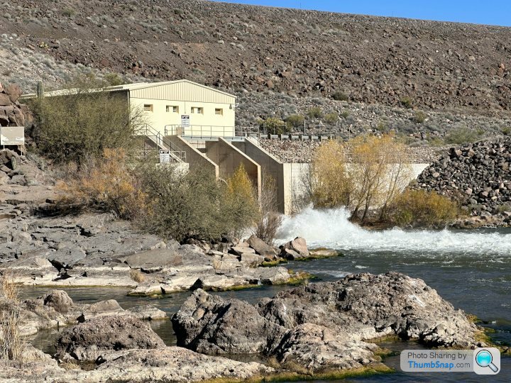
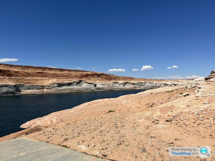
Behind sits Lake Mead, a vast reservoir created by the Dam. For years this complex has been a critical source of hydro power and water for 25 million people down stream. The dam releases regulated amounts of water to each state governed by complex agreements.
I was last here in November 2011. From a photo I took then the water level looked as follows:
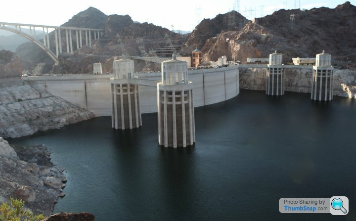 |https://thumbsnap.com/2qwDyKbv[/url]
This week it looked like this.
[url][url]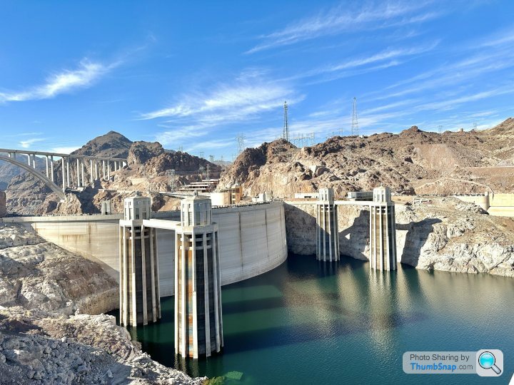
The water has fallen 70 feet and continues to fall.
This brought me to the Arizona-Nevada border.
Here sits the spectacular dam, a magnificent engineering feat.
|https://thumbsnap.com/vYH2DQYj[/url]Behind sits Lake Mead, a vast reservoir created by the Dam. For years this complex has been a critical source of hydro power and water for 25 million people down stream. The dam releases regulated amounts of water to each state governed by complex agreements.
I was last here in November 2011. From a photo I took then the water level looked as follows:
|https://thumbsnap.com/2qwDyKbv[/url]This week it looked like this.
[url][url]
The water has fallen 70 feet and continues to fall.
Edited by RDMcG on Tuesday 27th December 19:37
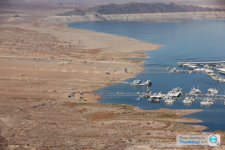
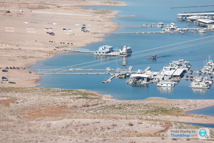
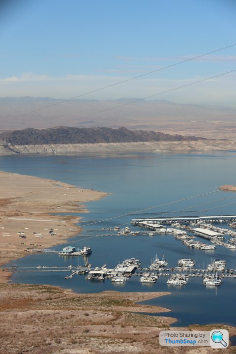
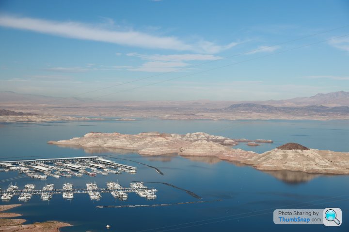
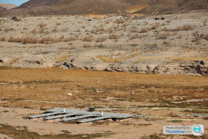
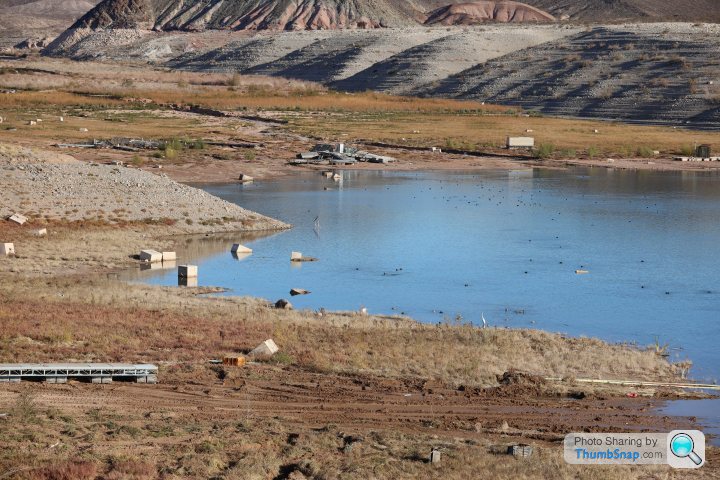
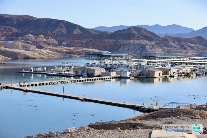
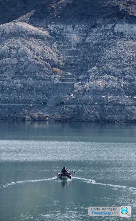
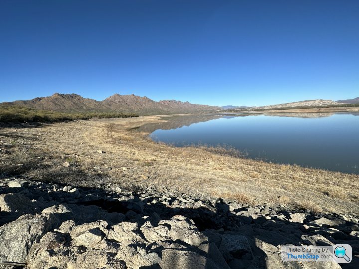
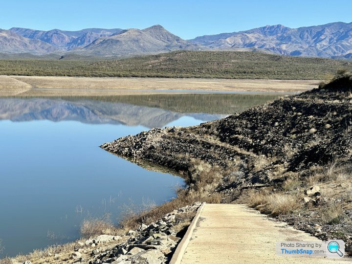
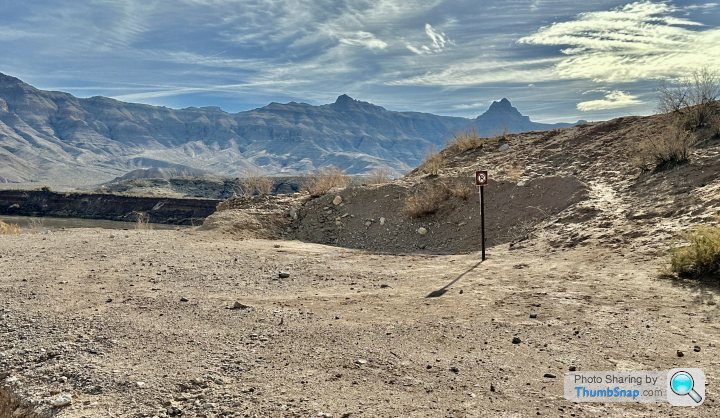
Lake Mead traditionally provides a lot of recreational opportunities for boaters and for fishing.
Today, the marinas are being continually relocated as the water recedes, and all sorts of artifacts are showing up, including a number of dead bodies.
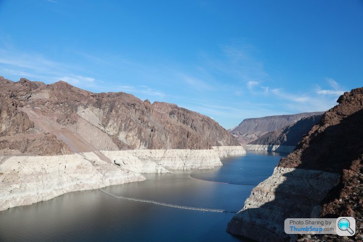
In these photos the smaller dark patches are where the high water mark was. The rest was underwater before the drought.
Today, the marinas are being continually relocated as the water recedes, and all sorts of artifacts are showing up, including a number of dead bodies.
In these photos the smaller dark patches are where the high water mark was. The rest was underwater before the drought.
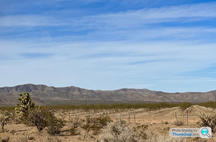
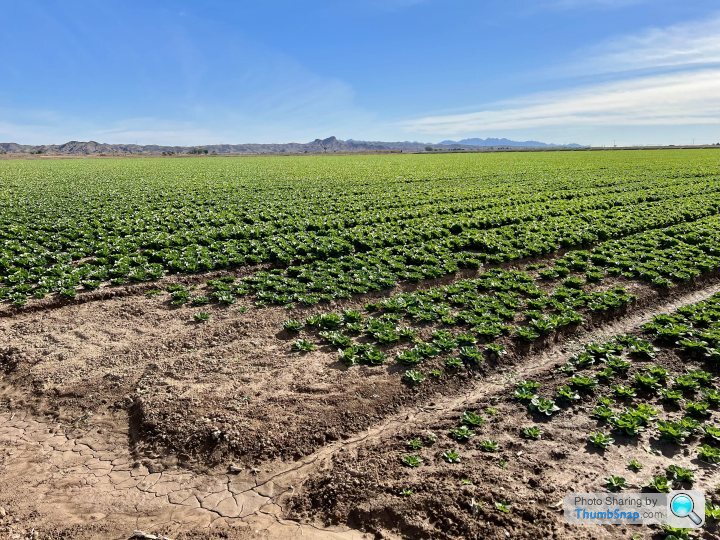
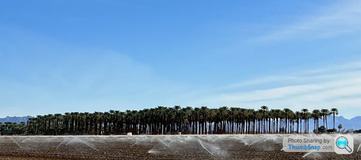
Yet, Arizona along with California remains a huge agricultural supplier to the rest of the country....
Evidence of irrigation starts immediately leaving the dam
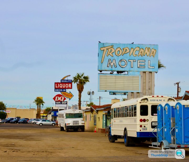
However, to really see the extent of the use of irrigation the place to visit is Yuma, a town right at the corner of Arizona on the California and Mexican borders. This is a faded place but advertises itself as the sunniest and driest city in the US.
The old motel row is now slowly becoming rooming houses for migrant agricultural workers.
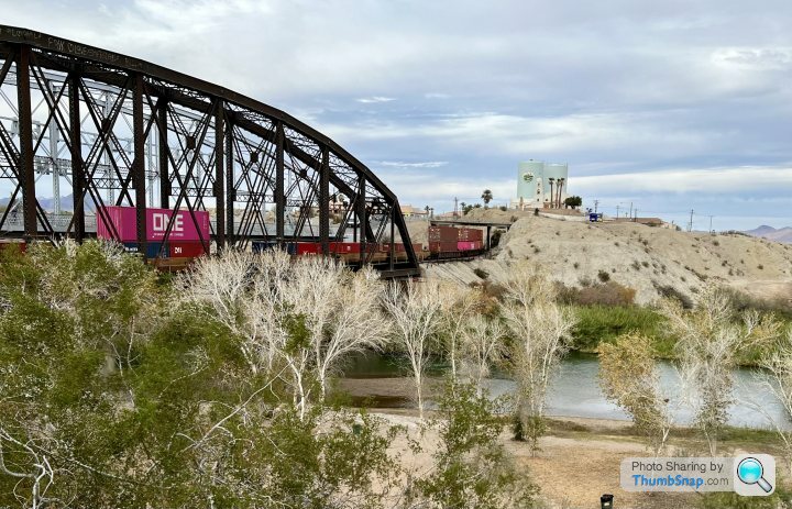
The remains of the Colorado river flow through to Mexico where it is absorbed immediately by more agriculture. It no longer reaches the Gulf. 100 years ago there were steamships coming to Yuma.
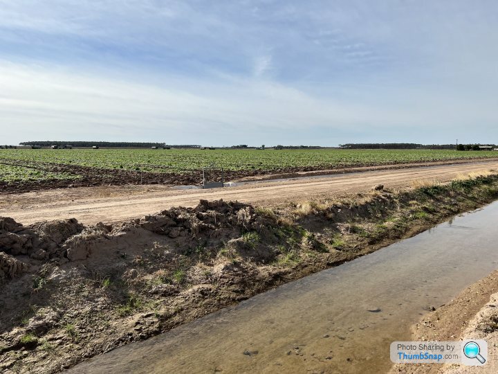
For miles and miles there are bright green fields, and this desert area supplies over 90% of the leafy vegetable to the US between November and February,.
Evidence of irrigation starts immediately leaving the dam
However, to really see the extent of the use of irrigation the place to visit is Yuma, a town right at the corner of Arizona on the California and Mexican borders. This is a faded place but advertises itself as the sunniest and driest city in the US.
The old motel row is now slowly becoming rooming houses for migrant agricultural workers.
The remains of the Colorado river flow through to Mexico where it is absorbed immediately by more agriculture. It no longer reaches the Gulf. 100 years ago there were steamships coming to Yuma.
For miles and miles there are bright green fields, and this desert area supplies over 90% of the leafy vegetable to the US between November and February,.
Edited by RDMcG on Tuesday 27th December 18:56
Thanks for sharing these.
I was last there in 2006 and the Hoover dam was not holding much, even back then - The bleached banksides were there for all to see.
I recall that Simon Reeve toured these regions a few years ago, statistics are easily forgotten, but I am pretty sure that he recorded that the ground levels in certain areas had dropped by as much as 60 feet as the water table was pumped out for irrigation.
I am ever the optimist, but I can only see the situation worsening.
There is a growing realization that the current situation cannot hold, and there will need to be a renegotiation of water rights. However, this is not going to increase supply overall - the very populous Southernmost states will demand a much bigger share from the states from where the water originates.
I am not very worried about the cities running out of water, but smaller communities without security of supply are going to be in trouble , and soon.
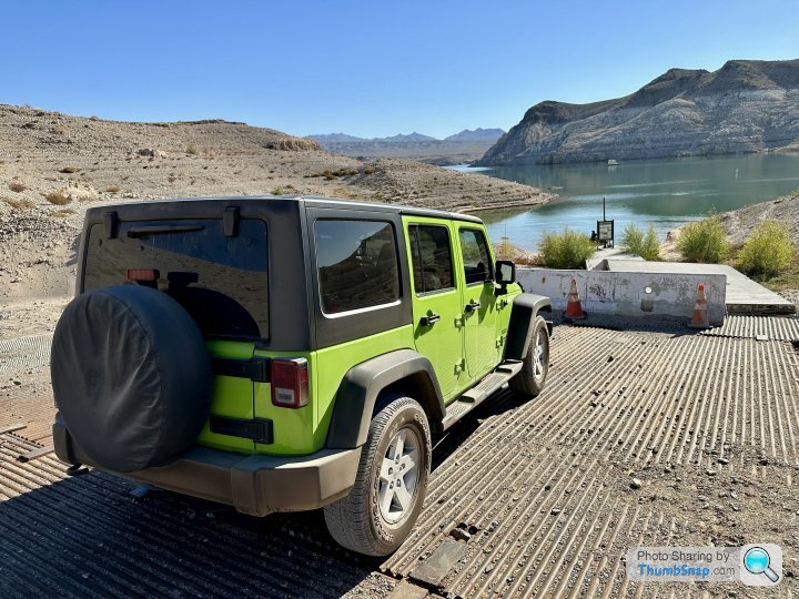
Still, for me it is a magnificent place of endless space and beauty, roads and trails where you can drive forever:
if you can find parking, that is:
I am not very worried about the cities running out of water, but smaller communities without security of supply are going to be in trouble , and soon.
Still, for me it is a magnificent place of endless space and beauty, roads and trails where you can drive forever:
if you can find parking, that is:
Edited by RDMcG on Tuesday 27th December 19:33
Whistle said:
This was lake powell in the summer, you can see the original water level. It’s at least 20m lower than it should be.
A local was saying if it drops much lower they are going to turn off the hydroelectric generators in the dam to save water.
Jazoli said:
Its frightening how much lake mead has dropped, I was there in 2005 and 2011 also and my pics resemble yours, looking at current levels now shows just how much water is missing.
Las Vegas has done some lakebed extraction now to ensure that they wile able to get water without an immediate problem. It is indeed scary.They've stopped all filming on Lake Mead, there are some good YouTube channels documenting the fall (and occasional rise) in levels, or there were anyway.
Went once, 2005ish, did a cruise on a lake and went into the depths of the Dam to see the turbines, even then you could see the marinas had been a lot higher and the bleaching was evident. This was prior to the road bridge being built which is featured on one of the above photos.
Can anybody recommend some information/videos from somebody more knowledgeable in how this might play out, or what might need to be done?
toastyhamster said:
They've stopped all filming on Lake Mead, there are some good YouTube channels documenting the fall (and occasional rise) in levels, or there were anyway.
Went once, 2005ish, did a cruise on a lake and went into the depths of the Dam to see the turbines, even then you could see the marinas had been a lot higher and the bleaching was evident. This was prior to the road bridge being built which is featured on one of the above photos.
Can anybody recommend some information/videos from somebody more knowledgeable in how this might play out, or what might need to be done?
Fairly up to date info below:Went once, 2005ish, did a cruise on a lake and went into the depths of the Dam to see the turbines, even then you could see the marinas had been a lot higher and the bleaching was evident. This was prior to the road bridge being built which is featured on one of the above photos.
Can anybody recommend some information/videos from somebody more knowledgeable in how this might play out, or what might need to be done?
https://www.reviewjournal.com/news/politics-and-go...
Gassing Station | Holidays & Travel | Top of Page | What's New | My Stuff