Easy green lanes in South of England for 2wd VW bus?
Discussion
Inspired by countless overland YouTube videos of old split screen buses crossing the wilderness, me and a couple of mates fancy some very light green laning.
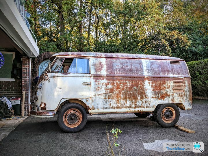
My bus is a 63 split screen with standard reduction gearbox axle, 1600cc on Goodyear Wrangler A/T tyres.
Can anyone recommend something not too taxing but gets us out into the countryside?
Cheers Jack
My bus is a 63 split screen with standard reduction gearbox axle, 1600cc on Goodyear Wrangler A/T tyres.
Can anyone recommend something not too taxing but gets us out into the countryside?
Cheers Jack
If you want to go laning check out trailwise, it shows you all the lanes, their status and often comments from people who have driven them.
Personally, I'd say you have the wrong vehicle. Most lanes are not all that challenging, but you could easily get stuck on very mild terrain a VW Type 2. Many lanes are also scratchy.
Personally, I'd say you have the wrong vehicle. Most lanes are not all that challenging, but you could easily get stuck on very mild terrain a VW Type 2. Many lanes are also scratchy.
300bhp/ton said:
If you want to go laning check out trailwise, it shows you all the lanes, their status and often comments from people who have driven them.
Personally, I'd say you have the wrong vehicle. Most lanes are not all that challenging, but you could easily get stuck on very mild terrain a VW Type 2. Many lanes are also scratchy.
Salisbury Plain might be a good start. However, go with somebody who does know the area, and I mean really does know the area( ie knows what the official definitive maps are etc etc), as many say they do, but don’t have a clue. Some of the plain is gravel road( ie the Old Marlborough road) but again, some of the obvious tracks may not have a legit right of way across them for you. As mentioned above, you’re in a very compromised vehicle for off-road, and even the slightest ruts will stop you dead. So plan accordingly, however the plain probably offers the best expanse where you can feel like you’re ‘out there’ and has some stunning scenery and wildlife.Personally, I'd say you have the wrong vehicle. Most lanes are not all that challenging, but you could easily get stuck on very mild terrain a VW Type 2. Many lanes are also scratchy.
Where abouts in the South of England? As noted above, many lanes are narrow and scratchy - if you have a half decent paint job it will suffer. You'll be surprised how capable they are though.
Search 'Baja club UK' on facebook - a group for Beetle based bajas but Includes some sandrails, syncros etc...
Search 'Baja club UK' on facebook - a group for Beetle based bajas but Includes some sandrails, syncros etc...
Do you have any form of recovery points front and rear?
While it is amazing where a vehicle can go. It is equally amazing how easily they can be stopped. I’d ensure you prepare for the worse even if you never use them.
It is staggeringly easy to make a minor mistake on unfamiliar terrain. Even if 95% of it is super easy.
What area of the country are you? I can take a look on trail wise and see if I can spot somewhere you can try.
roca1976 said:
I am Basingstoke/Newbury but happy to drive to Salisbury plains if that is the best place for gravel fire tracks.
Salisbury plain offers a lot. When dry most should be easy. Although you occasionally get some deep ruts or tram lines. When I’ve been there people seem to drive all over the place and not on the prescribed routes. I don’t endorse this and would suggest sticking strictly to the actual lanes. The lanes are often tougher than some of the service roads however.
I’ll jump on the PC later today and see if I can pull up some routes for you.
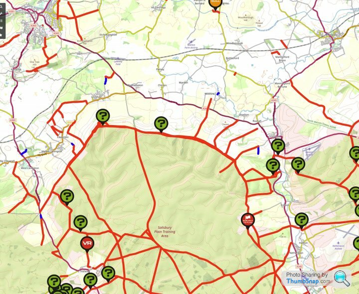
Pretty much all the military access tracks on Salisbury Plain are permissible, and are gravel so no issues with the bus, there are also lots of byways that aren’t suitable but they will be fairly obvious, the only thing to be aware of is if the red flags are flying which restricts access into the impact areas.
Also keep an eye out for when Imber is open (probably Easter) the routes in are accessible and there is lots of historic info about the village in the church.
Get the OS app it’s great for this sort of thing.
Also keep an eye out for when Imber is open (probably Easter) the routes in are accessible and there is lots of historic info about the village in the church.
Get the OS app it’s great for this sort of thing.
Just south of Devizes there are some suitable lanes, although I'd still avoid if wet in your vehicle.

Get yourself a mapping app on your smartphone or ipad. They are brilliant, as they are up to date and show you exactly where you are. You can also record where you drive, so that should you be questioned you have proof of sticking to the rights of way.
I use one called Outdoors GPS on my iPhone/iPad. Which uses OS maps and you can download to your device (very important as you usually have no phone signal on a lot of lanes). OS also do an app with works fine too, although I think is more online based.
gareth h said:
Pretty much all the military access tracks on Salisbury Plain are permissible, and are gravel so no issues with the bus, there are also lots of byways that aren’t suitable but they will be fairly obvious, the only thing to be aware of is if the red flags are flying which restricts access into the impact areas.
Also keep an eye out for when Imber is open (probably Easter) the routes in are accessible and there is lots of historic info about the village in the church.
Get the OS app it’s great for this sort of thing.
Sorry to go slightly off topic, do you have any links to where to access Sailsbury plain and routes etc?, it's somewhere I've wanted to go for ages but haven't found a great deal of helpful info about and gave up a bit.Also keep an eye out for when Imber is open (probably Easter) the routes in are accessible and there is lots of historic info about the village in the church.
Get the OS app it’s great for this sort of thing.
Maybe there should be a PH Sailsbury Plain trip done, I bet a few people would be up for going!.
Walter Sobchak said:
Sorry to go slightly off topic, do you have any links to where to access Sailsbury plain and routes etc?, it's somewhere I've wanted to go for ages but haven't found a great deal of helpful info about and gave up a bit.
Maybe there should be a PH Sailsbury Plain trip done, I bet a few people would be up for going!.
Look on an OS map for the rights of way, plus use something like Trailwise to see which lanes are open or if they have a TRO on.Maybe there should be a PH Sailsbury Plain trip done, I bet a few people would be up for going!.
As for permissible access. I can't say I really saw anything that said this anywhere when I've been. There are lots of tracks, but most don't have a legal right of way on. Hence the use of modern mapping tools is very handy, to ensure you are on the right of way and not a track near by.
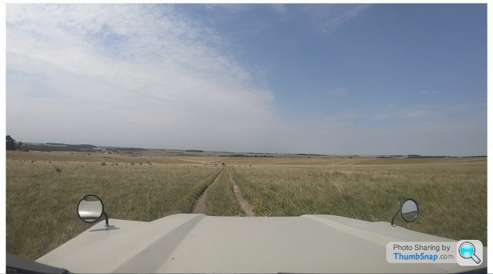
For example, here is one of the legal rights of way across the plain. As you can see away from the track it would be hard to see and doesn't look all that driven.
We parked up for a cup of tea before turning onto this particular lane. We saw not a single vehicle on it as all, but we must have seen at least 20 other vehicles driving where they shouldn't have been.

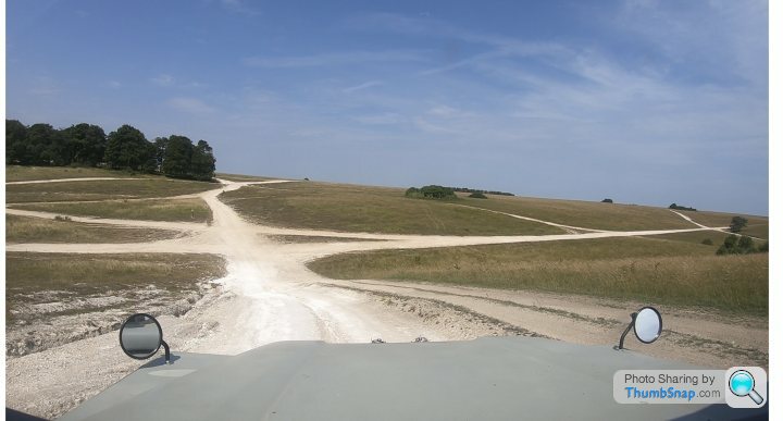
Other parts of the plain look a bit like this. A complete maze of roads, however there is only 1 legal right of way here. The rest is all off piste and shouldn't be driven.

Walter Sobchak said:
Sorry to go slightly off topic, do you have any links to where to access Sailsbury plain and routes etc?, it's somewhere I've wanted to go for ages but haven't found a great deal of helpful info about and gave up a bit.
Maybe there should be a PH Sailsbury Plain trip done, I bet a few people would be up for going!.
I lived there for 25 years so sort of new where to go without maps, as mentioned it can be a bit disorienting in some areas as there are no obvious landmarks, a good area to start is around Netheravon as there are wide gravel tracks each side of the A345, get yourself an OS map, or the App (which shows your position and just get lost, stick to the byways and you won’t go wrong, normally a fair amount of military traffic which is quite exciting if you haven’t experienced it before.Maybe there should be a PH Sailsbury Plain trip done, I bet a few people would be up for going!.
Walter Sobchak said:
Thanks 300 and Gareth, really solid advice and appreciated  I bet it's an amazing place to explore, I really would like to get around there this year, I do like the open ness of it, my car can be a bit big and cumbersome on some of the green lanes I've been on!.
The Dog and Gun at Netheravon has accommodation and decent beer if your planning on stopping over I bet it's an amazing place to explore, I really would like to get around there this year, I do like the open ness of it, my car can be a bit big and cumbersome on some of the green lanes I've been on!.
300bhp/ton said:
Just south of Devizes there are some suitable lanes, although I'd still avoid if wet in your vehicle.

Get yourself a mapping app on your smartphone or ipad. They are brilliant, as they are up to date and show you exactly where you are. You can also record where you drive, so that should you be questioned you have proof of sticking to the rights of way.
I use one called Outdoors GPS on my iPhone/iPad. Which uses OS maps and you can download to your device (very important as you usually have no phone signal on a lot of lanes). OS also do an app with works fine too, although I think is more online based.
My stomping grounds. 
Get yourself a mapping app on your smartphone or ipad. They are brilliant, as they are up to date and show you exactly where you are. You can also record where you drive, so that should you be questioned you have proof of sticking to the rights of way.
I use one called Outdoors GPS on my iPhone/iPad. Which uses OS maps and you can download to your device (very important as you usually have no phone signal on a lot of lanes). OS also do an app with works fine too, although I think is more online based.
There are some fab trails around this area, but I would say as a note of caution, even some of the fire roads can be very slippery when wet. The ground is compacted gravel and chalk, which in a 2wd van could cause you some issues. But take your time and please make sure you have strong recovery points on your van.
P.s your van looks awesome!
Gassing Station | Off Road | Top of Page | What's New | My Stuff


