
Hells Canyon & Glacier National Park Trip (1700+ miles)
Discussion


After my recent roadtrip to spend sunrise through sunset at Crater Lake a month or two back, I had some crazy notions about taking it one step further for my next major trip (the single day 600 mile drives don't count anymore in my eyes).
With a 3 day weekend for Labor Day looming at the start of September I started making plans for what on paper looked to be a good 1700 mile mammoth roadtrip, which I would do over two and a half days of the extended weekend.
1700 miles in around 2 days, yup, you heard me right, where the hell was I planning to go, here's the rundown:-
Saturday AM - Drive from hotel through Columbia Gorge and onto Brownlee Dam on border with Idaho
Saturday afternoon - Explore Hells Canyon which is the deepest "gorge" in America (according to it's Wikipedia article)
Estimated mileage at this stage - 465 miles
Saturday PM - Head North through the mountains and valleys of Oregon & Washington, swing East into Idaho and then continue on into Montana in the direction of Glacier National Park
Estimated mileage at this stage - 915 miles
Sunday AM - Catch sunrise at East Glacier, spend the day exploring the National Park
Estimated mileage at this stage - 1060 miles
Sunday PM - Start the long drive back to the hotel.
Monday AM - Arrive back at the hotel
Estimated mileage at this stage - 1700 miles
With a 3 day weekend for Labor Day looming at the start of September I started making plans for what on paper looked to be a good 1700 mile mammoth roadtrip, which I would do over two and a half days of the extended weekend.
1700 miles in around 2 days, yup, you heard me right, where the hell was I planning to go, here's the rundown:-
Saturday AM - Drive from hotel through Columbia Gorge and onto Brownlee Dam on border with Idaho
Saturday afternoon - Explore Hells Canyon which is the deepest "gorge" in America (according to it's Wikipedia article)
Estimated mileage at this stage - 465 miles
Saturday PM - Head North through the mountains and valleys of Oregon & Washington, swing East into Idaho and then continue on into Montana in the direction of Glacier National Park
Estimated mileage at this stage - 915 miles
Sunday AM - Catch sunrise at East Glacier, spend the day exploring the National Park
Estimated mileage at this stage - 1060 miles
Sunday PM - Start the long drive back to the hotel.
Monday AM - Arrive back at the hotel
Estimated mileage at this stage - 1700 miles
Edited by baz7175 on Saturday 17th September 05:26
Stage 1 - Hotel to Brownlee Dam
I was up, showered and out the door of my hotel around 25 miles West of Portland for 4am and just as the sun was beginning to breach the horizon at 6.32am I was about to say my farewell to the Columbia River which was just about to wind it's way Northwards, whereas I would continue due East. The sunrise at the East end of the Columbia Gorge got my spirits up and boosted my hopes that this was going to turn out to be one hell of a weekend.
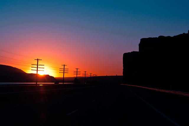
Sunrise Over Columbia Gorge by www.bazpics.com, on Flickr
After what seemed like forever it was time to finally stop driving due East and swing South towards Baker City, which lies in front of the Blue Mountains, which as like many things in America have been named based on how they looked to the casual observers who made their way across America in years gone past.
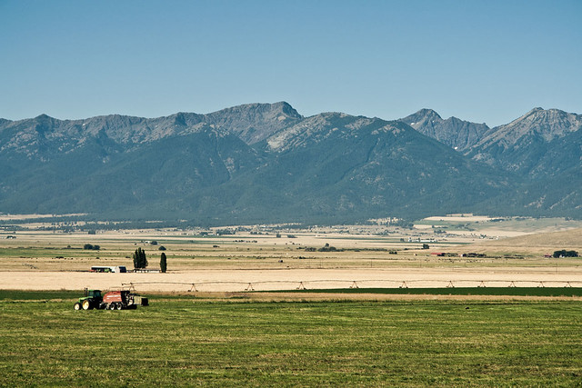
Hells Canyon Daytrip - The Blue Mountains by www.bazpics.com, on Flickr
After passing Baker City it was time to once again head East, in the direction of the tiny villages of Pine and Halfway which lie just on the West side of the Hells Canyon National Recreation area. As I approached the village of Pine, the green fields began to die away except for one single, solitary, lonely tree which looked completely out of place, and in the distance the huge cliffs of Hells Canyon began to dominate the skyline.
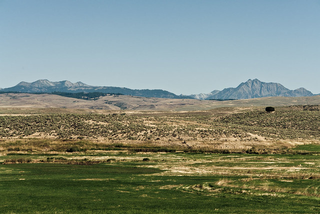
Hells Canyon Daytrip - First Glimpse & A Lonely Tree by www.bazpics.com, on Flickr
A little further along the road, it was time for a double take as I passed a roadsign, took a second or so to think if it said what I thought it did and then reverse back up the road to find out. After around four and a half hours of driving it was funny to have the "this is Sparta!" line running through my head.
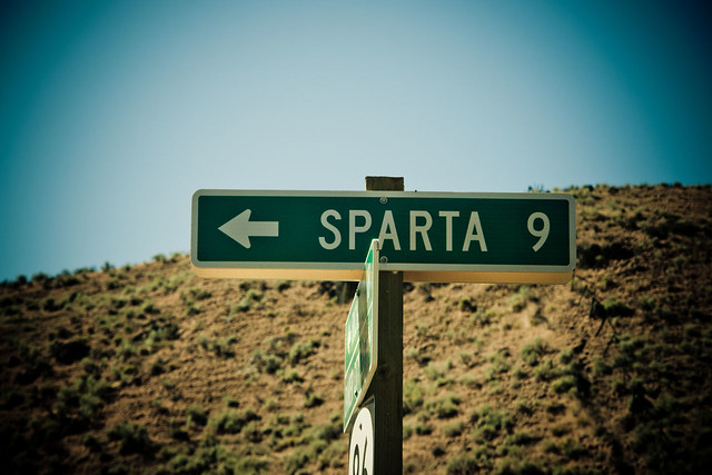
Hells Canyon Daytrip - This is... by www.bazpics.com, on Flickr
As I continued getting closer and closer to Hells Canyon the surrounding area turned more and more desert-like.
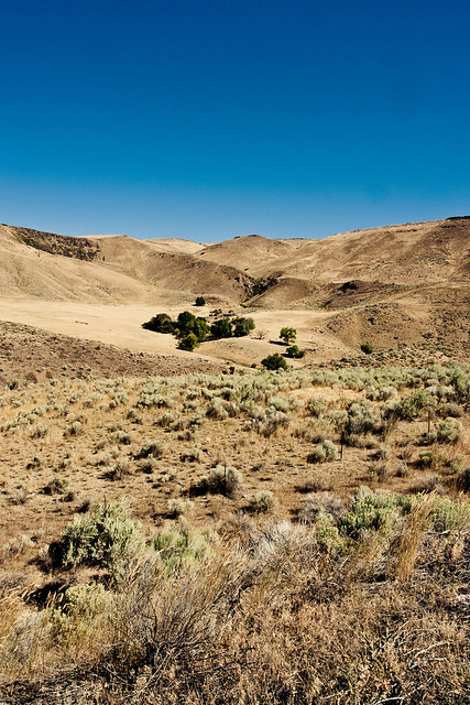
Hells Canyon Daytrip - Arid Landscape by www.bazpics.com, on Flickr
With so much desert-like area around, there was one farm which stuck out like a sore thumb due to how green its fields were, I wouldn't want to know how much money they have to spend on water to keep the place running, compared with how much easier it would be to do so 50 miles West of here.
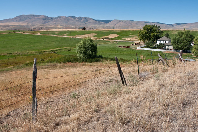
Hells Canyon Daytrip - Pasture In The Desert by www.bazpics.com, on Flickr
When you find yourself driving through mile upon mile of desert, the slighest blot of colour on the landscape grabs your attention, in this case a patch of sunflowers which lined the road. Sun, in this area comes in abundance, water is a whole different story, so as you can imagine the sunflowers no doubt were battling one another for the small amount of water on offer in the ground they sat on.
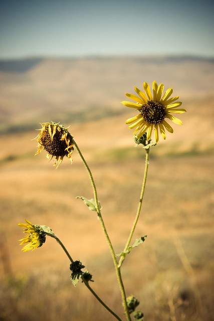
Hells Canyon Daytrip - The Will To Live by www.bazpics.com, on Flickr
Just outside of Pine was a little information area, which for all intents and purposes was a flat section of land with a loop to drive in and out of, it did however have a few cool features worthy of a photo.
First off the old grain tower which is looking pretty weather beaten now.

Hells Canyon Daytrip - Old Grain Tower by www.bazpics.com, on Flickr
And then the signpost, which appeared to show directions to almost every and any location within a hundred miles of it!
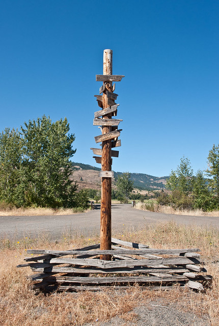
Hells Canyon Daytrip - Which Way Did You Say Again? by www.bazpics.com, on Flickr
I brushed along the South periphery of Hells Canyon, which offered a small glimpse of what was to come later in the day and met up with Snake River which winds it's way along the canyon floor to the North after it had swung from the East where the border with Idaho lay. The border of Oregon and Idaho is where Brownlee Dam is located, my first main stop of the day.
A view of the dam from the reservoir that lies above the valley floor.

Hells Canyon Daytrip - Brownlee Reservoir by www.bazpics.com, on Flickr
And then one of the valley floor which lies below.
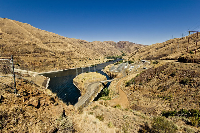
Hells Canyon Daytrip - Brownlee Dam by www.bazpics.com, on Flickr
After leaving Brownlee Dam it was time to follow the South bank of Snake River.
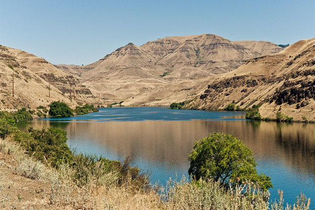
Hells Canyon Daytrip - Snake River by www.bazpics.com, on Flickr
Then it was time to head on North through the Hells Canyon National Recreation Area itself.
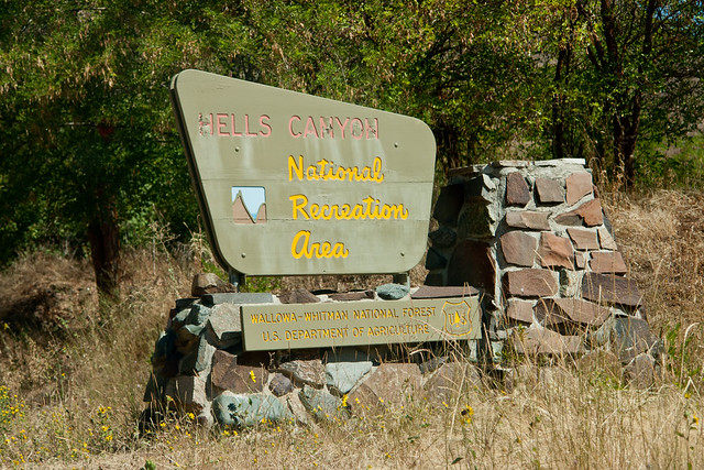
Hells Canyon Daytrip - National Recreation Area Sign by www.bazpics.com, on Flickr
The main overlook of Hells Canyon was what I can only describe as the same sort of view anyone who has visited the likes of the Grand Canyon would know - it's simply so massive that any attempt to take photographs of it seem to make it look small to the viewer. This exact reasoning applies to the panorama below of the canyon.
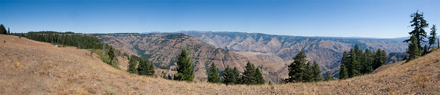
Hells Canyon Panorama (1280px) by www.bazpics.com, on Flickr
To put this into perspective - to drive from where I was standing to the peaks on the far side, my navigation system estimated just shy of 8 hours of driving, yup, I don't care what you say - that means it's BIG!
As I left the Hells Canyon area from it's North end it was time to take a note of my mileage to compare it with what I had estimated previously.
[b]Estimated mileage at this stage - 465 miles
Actual mileage at this stage - 531 miles[/b]
Now it was time for the daunting part of the trip - a 450 mile drive from Hells Canyon to the West entrance of Glacier National Park in Montana. My plan was to park up around 40 miles away from the park entrance and catch 2-3 hours of sleep in the car before sunrise. Having already covered 531 miles this meant having to cover just shy of 1000 miles, no mean feat along with all the stops and short walks/hikes I had done around Brownlee Dam and Hells Canyon.
The first 2 hours of this drive were probably the easiest, as I found myself having to wind my way through the valley floors and along the mountain passes which linked North East Oregon with South East Washington.
Here's a sample of just one of the views that I had from the top of one mountain, looking along the canyon.
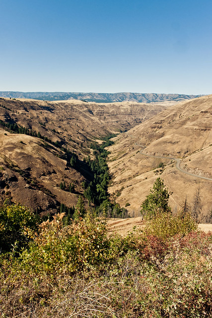
Hells Canyon Daytrip - Paradise Canyon by www.bazpics.com, on Flickr
And yup, that is the exact sort of road off to the right of the image that I mentioned above. The area here was called Paradise, personally I think they need to add the word "Driver" to the front of that - it certainly is!
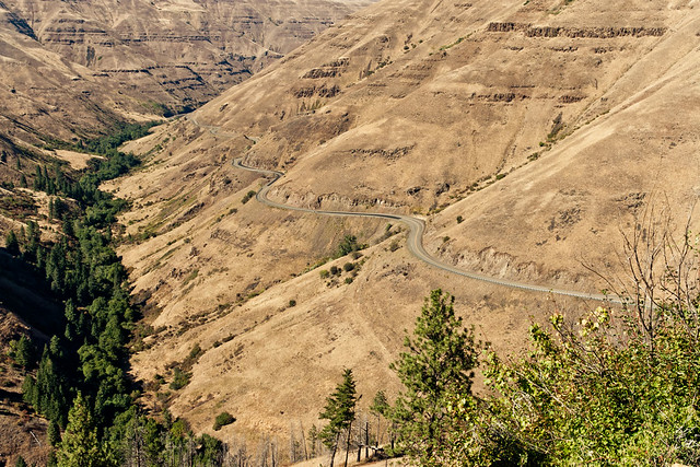
Hells Canyon Daytrip - A Drivers Dream by www.bazpics.com, on Flickr
It may have been great fun to drive, but unfortunately it was also bad for draining the energy which I still had in reserve, but somehow the lure of Glacier kept me pushing North through Washington, then East into Idaho (with the area which I was travelling through looking so flat in comparison to the landscape which I had left behind in Oregon and Washington)
As the cars clock, which was still one timezone behind after crossing from Pacific Savngs Time (PST) into Mountain Savings Time (MST), struck 11pm (midnight in local time) I was around 80 miles away from the entrance to Glacier and pushed on through the tiredness for another 40 miles to my planned "kip-stop" near the town of Somers which lay on the shores of Flathead Lake to the South West of Glacier National Park.
Finally it was time for a few hours shuteye, albeit in the not-so-comfy seat of my hirecar.
[b]Estimated mileage at this stage - 915 miles
Actual mileage at this stage - 984 miles[/b]
I was up, showered and out the door of my hotel around 25 miles West of Portland for 4am and just as the sun was beginning to breach the horizon at 6.32am I was about to say my farewell to the Columbia River which was just about to wind it's way Northwards, whereas I would continue due East. The sunrise at the East end of the Columbia Gorge got my spirits up and boosted my hopes that this was going to turn out to be one hell of a weekend.
Sunrise Over Columbia Gorge by www.bazpics.com, on Flickr
After what seemed like forever it was time to finally stop driving due East and swing South towards Baker City, which lies in front of the Blue Mountains, which as like many things in America have been named based on how they looked to the casual observers who made their way across America in years gone past.
Hells Canyon Daytrip - The Blue Mountains by www.bazpics.com, on Flickr
After passing Baker City it was time to once again head East, in the direction of the tiny villages of Pine and Halfway which lie just on the West side of the Hells Canyon National Recreation area. As I approached the village of Pine, the green fields began to die away except for one single, solitary, lonely tree which looked completely out of place, and in the distance the huge cliffs of Hells Canyon began to dominate the skyline.
Hells Canyon Daytrip - First Glimpse & A Lonely Tree by www.bazpics.com, on Flickr
A little further along the road, it was time for a double take as I passed a roadsign, took a second or so to think if it said what I thought it did and then reverse back up the road to find out. After around four and a half hours of driving it was funny to have the "this is Sparta!" line running through my head.
Hells Canyon Daytrip - This is... by www.bazpics.com, on Flickr
As I continued getting closer and closer to Hells Canyon the surrounding area turned more and more desert-like.
Hells Canyon Daytrip - Arid Landscape by www.bazpics.com, on Flickr
With so much desert-like area around, there was one farm which stuck out like a sore thumb due to how green its fields were, I wouldn't want to know how much money they have to spend on water to keep the place running, compared with how much easier it would be to do so 50 miles West of here.
Hells Canyon Daytrip - Pasture In The Desert by www.bazpics.com, on Flickr
When you find yourself driving through mile upon mile of desert, the slighest blot of colour on the landscape grabs your attention, in this case a patch of sunflowers which lined the road. Sun, in this area comes in abundance, water is a whole different story, so as you can imagine the sunflowers no doubt were battling one another for the small amount of water on offer in the ground they sat on.
Hells Canyon Daytrip - The Will To Live by www.bazpics.com, on Flickr
Just outside of Pine was a little information area, which for all intents and purposes was a flat section of land with a loop to drive in and out of, it did however have a few cool features worthy of a photo.
First off the old grain tower which is looking pretty weather beaten now.
Hells Canyon Daytrip - Old Grain Tower by www.bazpics.com, on Flickr
And then the signpost, which appeared to show directions to almost every and any location within a hundred miles of it!
Hells Canyon Daytrip - Which Way Did You Say Again? by www.bazpics.com, on Flickr
I brushed along the South periphery of Hells Canyon, which offered a small glimpse of what was to come later in the day and met up with Snake River which winds it's way along the canyon floor to the North after it had swung from the East where the border with Idaho lay. The border of Oregon and Idaho is where Brownlee Dam is located, my first main stop of the day.
A view of the dam from the reservoir that lies above the valley floor.
Hells Canyon Daytrip - Brownlee Reservoir by www.bazpics.com, on Flickr
And then one of the valley floor which lies below.
Hells Canyon Daytrip - Brownlee Dam by www.bazpics.com, on Flickr
After leaving Brownlee Dam it was time to follow the South bank of Snake River.
Hells Canyon Daytrip - Snake River by www.bazpics.com, on Flickr
Then it was time to head on North through the Hells Canyon National Recreation Area itself.
Hells Canyon Daytrip - National Recreation Area Sign by www.bazpics.com, on Flickr
The main overlook of Hells Canyon was what I can only describe as the same sort of view anyone who has visited the likes of the Grand Canyon would know - it's simply so massive that any attempt to take photographs of it seem to make it look small to the viewer. This exact reasoning applies to the panorama below of the canyon.
Hells Canyon Panorama (1280px) by www.bazpics.com, on Flickr
To put this into perspective - to drive from where I was standing to the peaks on the far side, my navigation system estimated just shy of 8 hours of driving, yup, I don't care what you say - that means it's BIG!
As I left the Hells Canyon area from it's North end it was time to take a note of my mileage to compare it with what I had estimated previously.
[b]Estimated mileage at this stage - 465 miles
Actual mileage at this stage - 531 miles[/b]
Now it was time for the daunting part of the trip - a 450 mile drive from Hells Canyon to the West entrance of Glacier National Park in Montana. My plan was to park up around 40 miles away from the park entrance and catch 2-3 hours of sleep in the car before sunrise. Having already covered 531 miles this meant having to cover just shy of 1000 miles, no mean feat along with all the stops and short walks/hikes I had done around Brownlee Dam and Hells Canyon.
The first 2 hours of this drive were probably the easiest, as I found myself having to wind my way through the valley floors and along the mountain passes which linked North East Oregon with South East Washington.
Here's a sample of just one of the views that I had from the top of one mountain, looking along the canyon.
Hells Canyon Daytrip - Paradise Canyon by www.bazpics.com, on Flickr
And yup, that is the exact sort of road off to the right of the image that I mentioned above. The area here was called Paradise, personally I think they need to add the word "Driver" to the front of that - it certainly is!
Hells Canyon Daytrip - A Drivers Dream by www.bazpics.com, on Flickr
It may have been great fun to drive, but unfortunately it was also bad for draining the energy which I still had in reserve, but somehow the lure of Glacier kept me pushing North through Washington, then East into Idaho (with the area which I was travelling through looking so flat in comparison to the landscape which I had left behind in Oregon and Washington)
As the cars clock, which was still one timezone behind after crossing from Pacific Savngs Time (PST) into Mountain Savings Time (MST), struck 11pm (midnight in local time) I was around 80 miles away from the entrance to Glacier and pushed on through the tiredness for another 40 miles to my planned "kip-stop" near the town of Somers which lay on the shores of Flathead Lake to the South West of Glacier National Park.
Finally it was time for a few hours shuteye, albeit in the not-so-comfy seat of my hirecar.
[b]Estimated mileage at this stage - 915 miles
Actual mileage at this stage - 984 miles[/b]
Edited by baz7175 on Saturday 17th September 05:29
Stage 2 - Glacier National Park
After sleeping (if you can call a game of doze off/wake up in 10min cycles) for around 2 hours it was time to get the car started and make my way through Glacier National Park from the West entrance, all the way through the "Road To The Sun Highway" to a few miles shy of the East entrance where I planned to capture the sunrise over Saint Mary Lake.
As the local time approached 4am, I was already sat in prime position alongside the lake which was so amazingly still compared to almost EVERY single image I had found on the internet prior to the trip. It was still completely dark at this stage, and with sunrise due to arrive around 4.45am I thought about grabbing another quick 15min snooze when it suddenly dawned (no pun intended) on me that I was miles and miles from any civilisation and was thousands of feet up in the air.
Why didn't I look up before now, argh, ometimes I really, really, really could kick myself, HARD!
It wasn't until now that I realised what I had squandered in during the few hours of sleep I had in the car.
STARS!!!!
And lots of them, I was parked around 40 miles outside the West entrance to Glacier from around midnight to 3am, and the skies were clear all night. I blame the heated seats in the hirecar for my lack of awesome star and milkyway pictures that COULD have been captured had I not fallen asleep so easily...
...so here is one of the small number of star shots I took while capturing the sunrise at Saint Mary Lake.
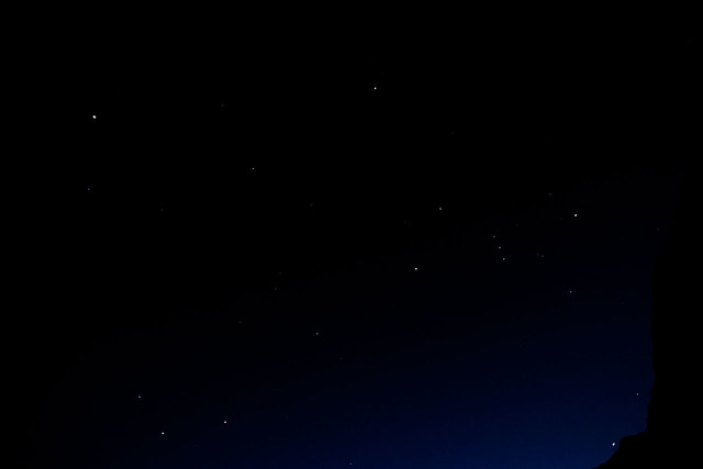
Stars Over Glacier National Park by www.bazpics.com, on Flickr
It was only now that I was beginning to wonder if I would have any others planning to enjoy the sunrise too, human perhaps, or even the large 4-legged variety, as lets face it - there's over 3000 bears in the park, a mixture of Black and Grizzly varieties, and I'm not a fan of fighting with either!
Just before 4.30am the sky was beginning to light up with colour as the sun put on it's daily show.
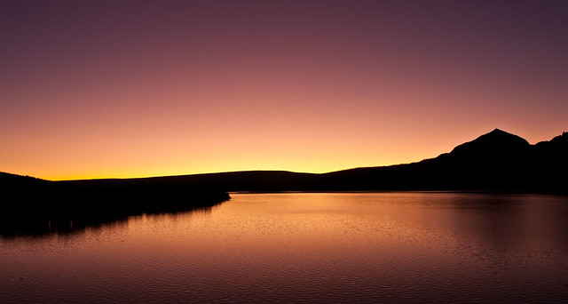
Glacier National Park - Saint Mary Lake Sunrise by www.bazpics.com, on Flickr
I'll be honest, after shooting a sequence of images at this stage of the sunrise, the main event itself just seemed "flat" in comparison, so I packed up the kit and drove a few miles back West to where I could shoot back into the mountains of the park, with Saint Mary Lake still in the foreground, and using Wild Goose Island to break up the surface of the lake. You can see the sunlight is just starting to spill onto the tops of the mountains which guard the waters of the lake below it, at this stage is was around 5.45am.
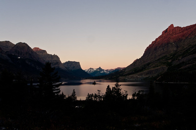
Glacier National Park Trip - Early Morning Darkness by www.bazpics.com, on Flickr
This location was probably the place that I was most jumpy, as I was the only person standing in this area, down in the woods, with nothing but trees, bushes, and lots of nice hiding places for those bears...I reckon every time I hit the shutter button standing there I did a complete 360 degree scan of my surrounding area incase I needed to make an emergency sprint back up to the car, thankfully nothing appeared and I spent the next hour there capturing the changing light over the lake and mountains.
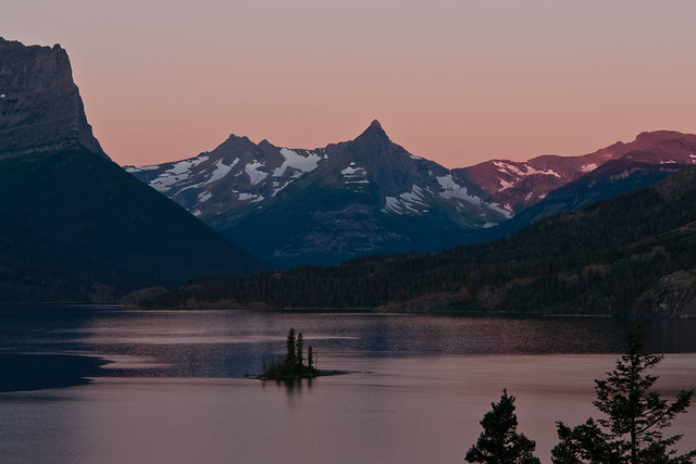
Glacier National Park Trip - Those Amazing Colours by www.bazpics.com, on Flickr
Almost as quickly as the colours over the lake became pinkish, they began to transition to a more reddiish-orange glow, as the sun began to spread it's light on the hills which surround the lake.
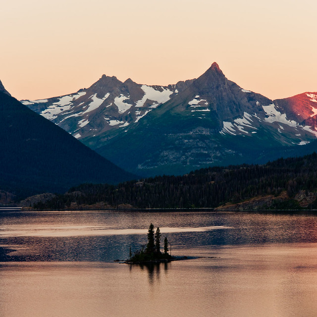
Glacier National Park Trip - The Transition by www.bazpics.com, on Flickr
It's at this point in time where the light is changing pretty much second by second that it gets tougher and tougher to keep everything exposed just enough to prevent blowing out the highlights or the shadows looking like they are still in the dead of night.
I have seveal custom functions set up on my 60D, which this photo is shot on instead of my normal Sony R1 that takes care of the normal landscape shots.
Using the 60D also let me through the scene into wide angle mode as I had brought along my 10-20mm lens among others.
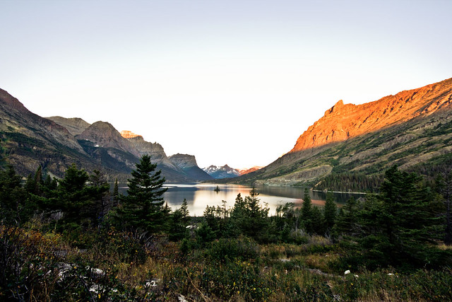
Glacier National Park Trip - Time For the 60D To Show It's Stuff by www.bazpics.com, on Flickr
The light begins to spread onto the hillside, bringing colour to all that was shadow.
In this one you'll see that the water looks pretty plain now, with some reflection showing but quite bland.
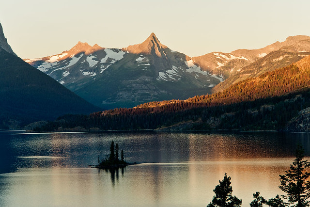
Glacier National Park Trip - Let There Be Light by www.bazpics.com, on Flickr
Now, only a matter of minutes later the light has filled the bank of the lake with colour, and the water which looked quite bland only a few minutes earlier now displays a colourful reflection of the bank.
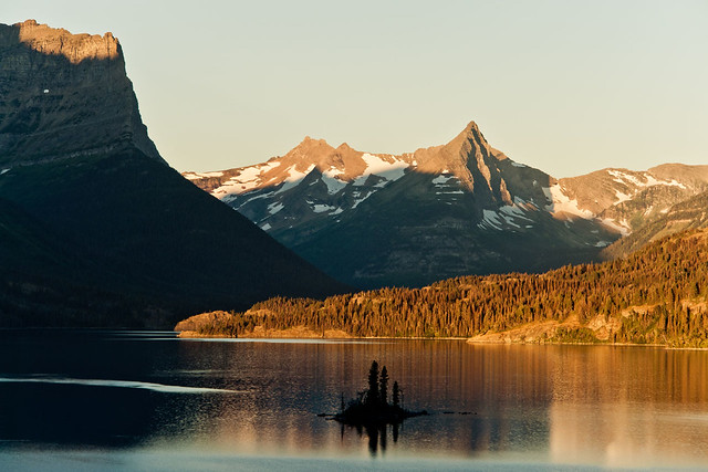
Glacier National Park Trip - Reflections In The Ripples by www.bazpics.com, on Flickr
The next hour or so I slowly made my way from Rising Sun on the banks of Saint Mary Lake, West along the Road To The Sun Highway - this time in daylight, which allowed great views of some of the mountains which make up the National Park.
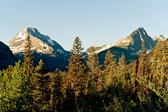
Glacier National Park Trip - Mt Logan & Mt Jackson by www.bazpics.com, on Flickr
As I drew close to the Visitor Centre high up in the mountains at Logan Pass I could get an idea of what lay off to the sides of the road that I had driven along in the dark of night - huge drops off the side of the cliff!
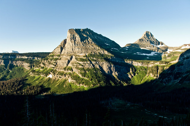
Glacier National Park Trip - Bathed In Light by www.bazpics.com, on Flickr
The carpark at Logan Pass normally begins filling up quickly from around 9am, which for most people is the timeframe that they intend to reach it - for me that "normal time of day" was still a good 90mins away when I parked up the car and after picking up the gear, made my way up past the Visitor Centre towards Clements Mountain.
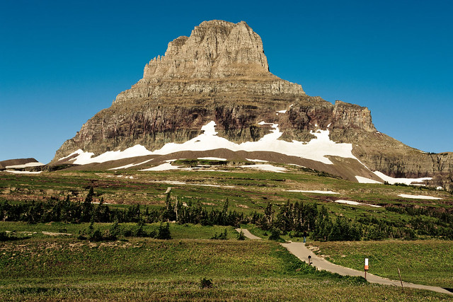
Glacier National Park Trip - Clements Mountain by www.bazpics.com, on Flickr
You can already see the start of the path which leads you up towards Clements Mountain, before swinging over it's left flank en route to Hidden Lake which lies a few miles away. After around a few hundred feet the stone path turns into a raised wooden walkway which winds it's way over the Alpine meadow. The Apline meadow is home to hundreds of Marmots, which is a cousin of the squirrel - but is MUCH larger than it...
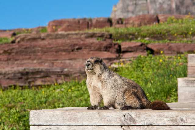
Glacier National Park Trip - What A Poser by www.bazpics.com, on Flickr
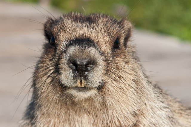
Glacier National Park Trip - Smile Please by www.bazpics.com, on Flickr
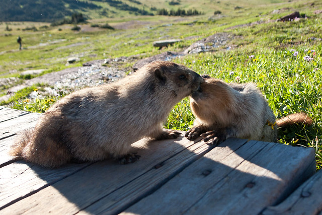
Glacier National Park Trip - Mr Marmots Adoring Fan Club by www.bazpics.com, on Flickr
As you approach the base of Clements Mountain there are large areas littered with loose rocks that have broken away from it's parent mountain.
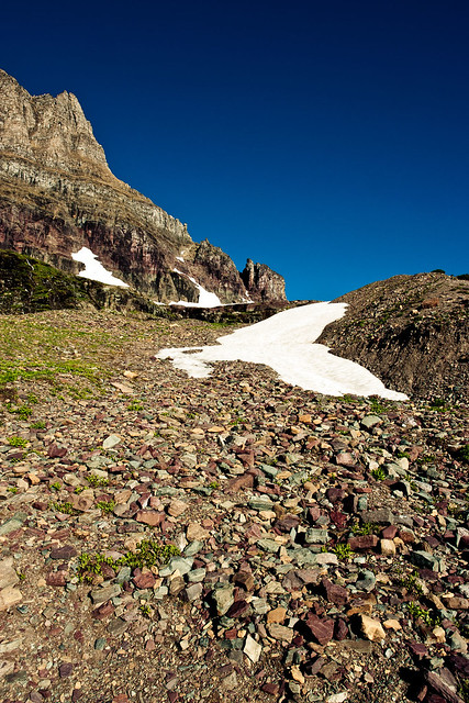
Glacier National Park Trip - Some More Colourful Stones by www.bazpics.com, on Flickr
The colours which show up in the stone slurries are down to the large variety of minerals which are abundant in the mountains of Glacier National Park.
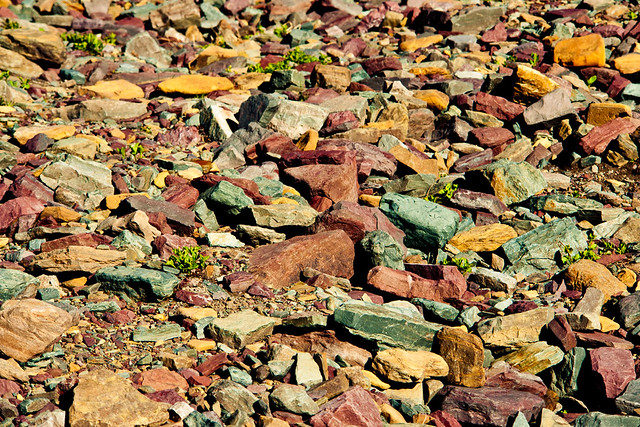
Glacier National Park Trip - Coloured Stones by www.bazpics.com, on Flickr
On the plateau which lies to the South of Clements Mountain the pathway winds itself through another section which has has a large rockfall and a small lake which has come into being due to all of the snow which has melted recently.
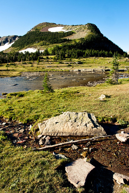
Glacier National Park Trip - Puddles In The Sky by www.bazpics.com, on Flickr
There's still plenty of snow around the park, albeit patchy now that it's September. It won't be long until the snow begins to fall and makes this area impossible to reach easily for the best part of another year.
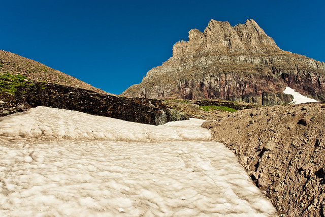
Glacier National Park Trip - Patchy Snow by www.bazpics.com, on Flickr
As you get closer to the cliff faces of Clements Mountain there's a much better view of the changing colours which make up the mountain.
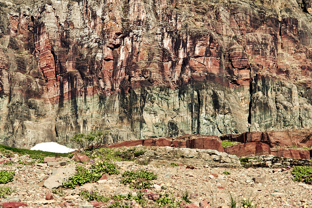
Glacier National Park Trip - Red Rock Point by www.bazpics.com, on Flickr
Another half mile or so hike finally brings the scenery which holds Hidden Lake in it's arms into view with Mount Brown towering behind it.
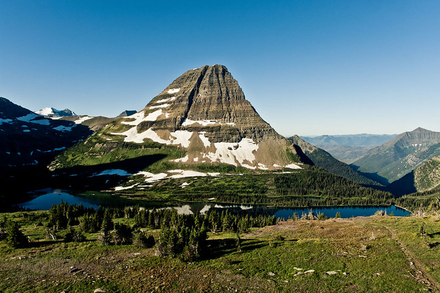
Glacier National Park Trip - Hidden Lake Viewpoint by www.bazpics.com, on Flickr
Again, hiking through areas of the vast winderness has you a little on edge as far as keeping your eyes peeled for the local wildlife, thankfully the only animals other than the Marmots that I came across were a few goats who only seemed a little miffed at me wandering across "their" turf!
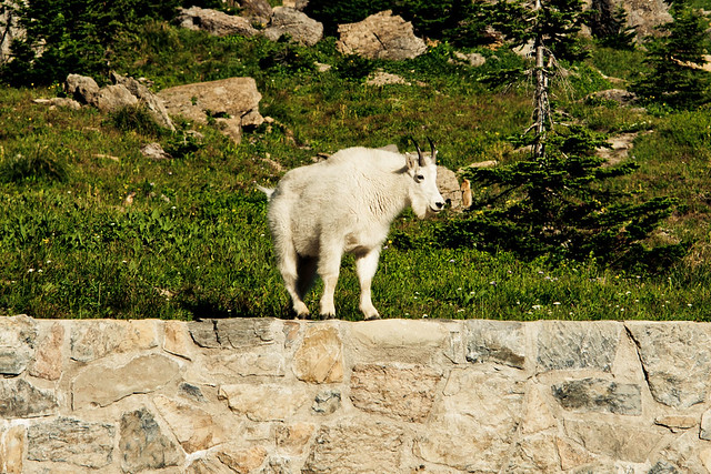
Glacier National Park Trip - The Parking Attendant by www.bazpics.com, on Flickr
The walk back down to the Logan Pass Visitor Centre gave a whole different perspective on the high Alpine Meadow area, as the sun had now risen high enough into the sky to let me capture some shots of the other mountains which surround this area of the park. First off lets look to the South.
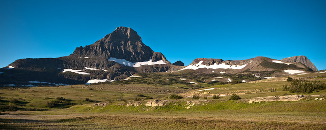
Glacier National Park Trip - View From Logan Pass by www.bazpics.com, on Flickr
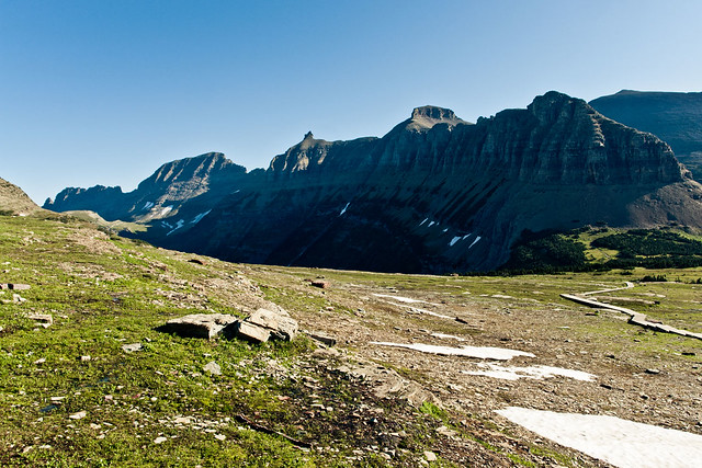
And then to the North there is the huge cliff face which has probably the most fitting name it could ever have - The Garden Wall, and what a garden it is too!
Glacier National Park Trip - The Garden Wall by www.bazpics.com, on Flickr
The Alpine Meadow was also home to a massive number of flowers, which must have a tough life trying to bloom in such an area of the world.

Glacier National Park Trip - Let The Dance Begin by www.bazpics.com, on Flickr
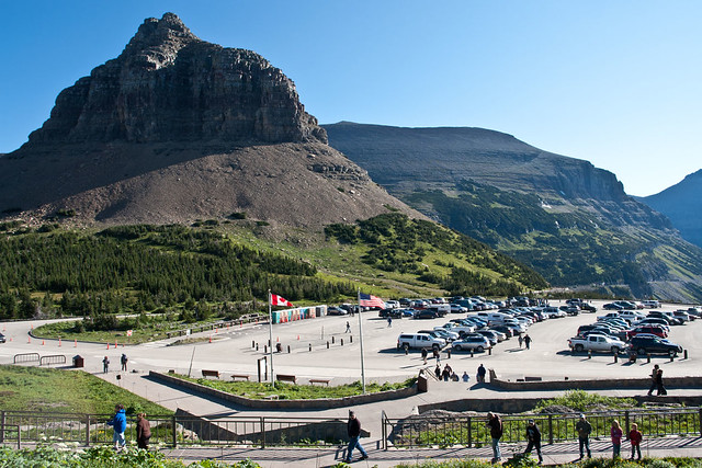
It's when you find yourself standing in the area of Logan Pass that you get a true sense of just how much of this landscape has been created by the movements of the tectonic plates far beneath your feet. Glacier National Park is only a small section of the the massive range of mountains which run from the North of Canada all the way down through Mexico, where two continents come together, otherwise known as the Continental Divide.
Glacier National Park Trip - Logan Pass by www.bazpics.com, on Flickr
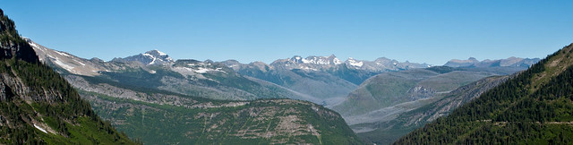
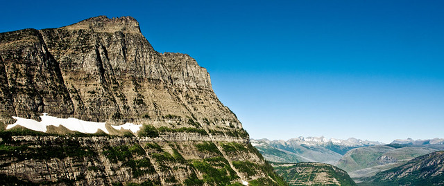
The drive back down the mountain pass road offers some amazing views of the valley which lies before it, as well as the likes of Mount Oberlin which has probably the best view in the park.
Glacier National Park Trip - A Panoramic Vista To Die For by www.bazpics.com, on Flickr
Glacier National Park Trip - Mount Oberlin's View by www.bazpics.com, on Flickr
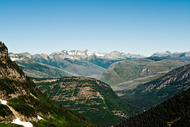
Glacier National Park Trip - Stunning Vista by www.bazpics.com, on Flickr
Once again, the drive in daylight gave more of an insight into the road I drove in complete darkness around 9 hours previously.
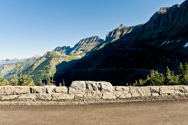
Glacier National Park Trip - Heading West by www.bazpics.com, on Flickr
As well as the amazing views of the mountains of the park, McDonald Creek is also on show from Packers Roost as you begin your decent from Logan Pass towards Crystal Point.
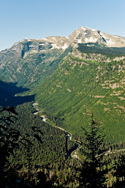
Glacier National Park Trip - McDonald Creek from Packers Roost by www.bazpics.com, on Flickr
The sheer devastation that's caused by fires in the national parks is all too visible to see, some are caused by nature, i.e. lightning etc, but unfortunately there's still way too many fires started accidentally by people visiting the park...
Heaven's Peak stands proudly on the far side of the decimated valley before it.
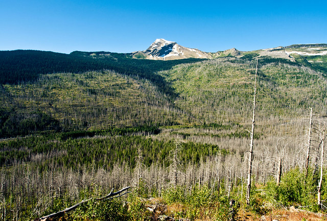
Glacier National Park Trip - Wildfires by www.bazpics.com, on Flickr
As you continue winding your way back down towards the valley floor, the likes of Heaven's Peak, Stanton Mountain and Mount Vaught get close enough for you to make out all the lines and erosion which make up their faces and peaks.
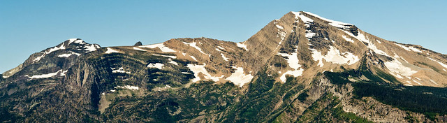
Glacier National Park Trip - Stanton & Vaught by www.bazpics.com, on Flickr
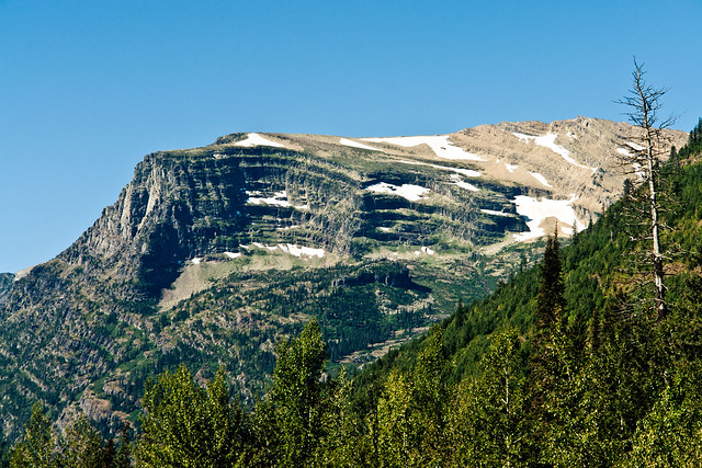
Glacier National Park Trip - Stanton's Erosion by www.bazpics.com, on Flickr
And my final shot from the West side of the park was to try and capture the glacier colours in the water of Lake McDonald, which I probably hit at the completely wrong time of day, as the colours which normally light up the lake were only on show in the shallow water near the lakes shore.
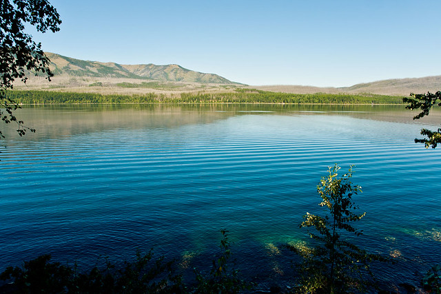
Glacier National Park Trip - A Touch Of Magical Colour by www.bazpics.com, on Flickr
It was now time to leave Glacier National Park behind and begin the final stage of my journey, a 640 mile drive back through Montana, Idaho, Washington and Oregon.
Estimated mileage at this stage - 1060 miles
Actual mileage at this stage - 1210 miles
As I approached Portland along the banks of the Columbia River Gorge, the same area which had shown me colour in it's sunrise the morning before put on one hell of a sunset show.
This photo opportunity came as a bit of a surprise for me and about 100 or so other carloads of passengers who did their best to bring the slow lane of I-84 to a complete halt (thankfully there was enough space for me to squeeze into one of the last available spots at the viewpoint off of the main interstate).
The sunset looking West over the Columbia River was jaw-droppingly stunning, and even though cars were pulling to a halt all over the interstate to soak it in fully, I never heard a single horn get honked in frustration, one of those "special" moments...
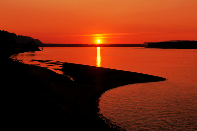
Sunset Over The Columbia River by www.bazpics.com, on Flickr
Around 2 hours later I was back at my hotel, weary, tired and ready for bed after covering a grand total of 1850 miles in around 42 hours.
Estimated mileage at this stage - 1700 miles
Actual mileage at this stage - 1850 miles
One hell of a trip, and I think I'll stick to my single day, 600 mile stints for the coming weeks...
After sleeping (if you can call a game of doze off/wake up in 10min cycles) for around 2 hours it was time to get the car started and make my way through Glacier National Park from the West entrance, all the way through the "Road To The Sun Highway" to a few miles shy of the East entrance where I planned to capture the sunrise over Saint Mary Lake.
As the local time approached 4am, I was already sat in prime position alongside the lake which was so amazingly still compared to almost EVERY single image I had found on the internet prior to the trip. It was still completely dark at this stage, and with sunrise due to arrive around 4.45am I thought about grabbing another quick 15min snooze when it suddenly dawned (no pun intended) on me that I was miles and miles from any civilisation and was thousands of feet up in the air.
Why didn't I look up before now, argh, ometimes I really, really, really could kick myself, HARD!
It wasn't until now that I realised what I had squandered in during the few hours of sleep I had in the car.
STARS!!!!
And lots of them, I was parked around 40 miles outside the West entrance to Glacier from around midnight to 3am, and the skies were clear all night. I blame the heated seats in the hirecar for my lack of awesome star and milkyway pictures that COULD have been captured had I not fallen asleep so easily...
...so here is one of the small number of star shots I took while capturing the sunrise at Saint Mary Lake.
Stars Over Glacier National Park by www.bazpics.com, on Flickr
It was only now that I was beginning to wonder if I would have any others planning to enjoy the sunrise too, human perhaps, or even the large 4-legged variety, as lets face it - there's over 3000 bears in the park, a mixture of Black and Grizzly varieties, and I'm not a fan of fighting with either!
Just before 4.30am the sky was beginning to light up with colour as the sun put on it's daily show.
Glacier National Park - Saint Mary Lake Sunrise by www.bazpics.com, on Flickr
I'll be honest, after shooting a sequence of images at this stage of the sunrise, the main event itself just seemed "flat" in comparison, so I packed up the kit and drove a few miles back West to where I could shoot back into the mountains of the park, with Saint Mary Lake still in the foreground, and using Wild Goose Island to break up the surface of the lake. You can see the sunlight is just starting to spill onto the tops of the mountains which guard the waters of the lake below it, at this stage is was around 5.45am.
Glacier National Park Trip - Early Morning Darkness by www.bazpics.com, on Flickr
This location was probably the place that I was most jumpy, as I was the only person standing in this area, down in the woods, with nothing but trees, bushes, and lots of nice hiding places for those bears...I reckon every time I hit the shutter button standing there I did a complete 360 degree scan of my surrounding area incase I needed to make an emergency sprint back up to the car, thankfully nothing appeared and I spent the next hour there capturing the changing light over the lake and mountains.
Glacier National Park Trip - Those Amazing Colours by www.bazpics.com, on Flickr
Almost as quickly as the colours over the lake became pinkish, they began to transition to a more reddiish-orange glow, as the sun began to spread it's light on the hills which surround the lake.
Glacier National Park Trip - The Transition by www.bazpics.com, on Flickr
It's at this point in time where the light is changing pretty much second by second that it gets tougher and tougher to keep everything exposed just enough to prevent blowing out the highlights or the shadows looking like they are still in the dead of night.
I have seveal custom functions set up on my 60D, which this photo is shot on instead of my normal Sony R1 that takes care of the normal landscape shots.
Using the 60D also let me through the scene into wide angle mode as I had brought along my 10-20mm lens among others.
Glacier National Park Trip - Time For the 60D To Show It's Stuff by www.bazpics.com, on Flickr
The light begins to spread onto the hillside, bringing colour to all that was shadow.
In this one you'll see that the water looks pretty plain now, with some reflection showing but quite bland.
Glacier National Park Trip - Let There Be Light by www.bazpics.com, on Flickr
Now, only a matter of minutes later the light has filled the bank of the lake with colour, and the water which looked quite bland only a few minutes earlier now displays a colourful reflection of the bank.
Glacier National Park Trip - Reflections In The Ripples by www.bazpics.com, on Flickr
The next hour or so I slowly made my way from Rising Sun on the banks of Saint Mary Lake, West along the Road To The Sun Highway - this time in daylight, which allowed great views of some of the mountains which make up the National Park.
Glacier National Park Trip - Mt Logan & Mt Jackson by www.bazpics.com, on Flickr
As I drew close to the Visitor Centre high up in the mountains at Logan Pass I could get an idea of what lay off to the sides of the road that I had driven along in the dark of night - huge drops off the side of the cliff!
Glacier National Park Trip - Bathed In Light by www.bazpics.com, on Flickr
The carpark at Logan Pass normally begins filling up quickly from around 9am, which for most people is the timeframe that they intend to reach it - for me that "normal time of day" was still a good 90mins away when I parked up the car and after picking up the gear, made my way up past the Visitor Centre towards Clements Mountain.
Glacier National Park Trip - Clements Mountain by www.bazpics.com, on Flickr
You can already see the start of the path which leads you up towards Clements Mountain, before swinging over it's left flank en route to Hidden Lake which lies a few miles away. After around a few hundred feet the stone path turns into a raised wooden walkway which winds it's way over the Alpine meadow. The Apline meadow is home to hundreds of Marmots, which is a cousin of the squirrel - but is MUCH larger than it...
Glacier National Park Trip - What A Poser by www.bazpics.com, on Flickr
Glacier National Park Trip - Smile Please by www.bazpics.com, on Flickr
Glacier National Park Trip - Mr Marmots Adoring Fan Club by www.bazpics.com, on Flickr
As you approach the base of Clements Mountain there are large areas littered with loose rocks that have broken away from it's parent mountain.
Glacier National Park Trip - Some More Colourful Stones by www.bazpics.com, on Flickr
The colours which show up in the stone slurries are down to the large variety of minerals which are abundant in the mountains of Glacier National Park.
Glacier National Park Trip - Coloured Stones by www.bazpics.com, on Flickr
On the plateau which lies to the South of Clements Mountain the pathway winds itself through another section which has has a large rockfall and a small lake which has come into being due to all of the snow which has melted recently.
Glacier National Park Trip - Puddles In The Sky by www.bazpics.com, on Flickr
There's still plenty of snow around the park, albeit patchy now that it's September. It won't be long until the snow begins to fall and makes this area impossible to reach easily for the best part of another year.
Glacier National Park Trip - Patchy Snow by www.bazpics.com, on Flickr
As you get closer to the cliff faces of Clements Mountain there's a much better view of the changing colours which make up the mountain.
Glacier National Park Trip - Red Rock Point by www.bazpics.com, on Flickr
Another half mile or so hike finally brings the scenery which holds Hidden Lake in it's arms into view with Mount Brown towering behind it.
Glacier National Park Trip - Hidden Lake Viewpoint by www.bazpics.com, on Flickr
Again, hiking through areas of the vast winderness has you a little on edge as far as keeping your eyes peeled for the local wildlife, thankfully the only animals other than the Marmots that I came across were a few goats who only seemed a little miffed at me wandering across "their" turf!
Glacier National Park Trip - The Parking Attendant by www.bazpics.com, on Flickr
The walk back down to the Logan Pass Visitor Centre gave a whole different perspective on the high Alpine Meadow area, as the sun had now risen high enough into the sky to let me capture some shots of the other mountains which surround this area of the park. First off lets look to the South.
Glacier National Park Trip - View From Logan Pass by www.bazpics.com, on Flickr
And then to the North there is the huge cliff face which has probably the most fitting name it could ever have - The Garden Wall, and what a garden it is too!
Glacier National Park Trip - The Garden Wall by www.bazpics.com, on Flickr
The Alpine Meadow was also home to a massive number of flowers, which must have a tough life trying to bloom in such an area of the world.
Glacier National Park Trip - Let The Dance Begin by www.bazpics.com, on Flickr
It's when you find yourself standing in the area of Logan Pass that you get a true sense of just how much of this landscape has been created by the movements of the tectonic plates far beneath your feet. Glacier National Park is only a small section of the the massive range of mountains which run from the North of Canada all the way down through Mexico, where two continents come together, otherwise known as the Continental Divide.
Glacier National Park Trip - Logan Pass by www.bazpics.com, on Flickr
The drive back down the mountain pass road offers some amazing views of the valley which lies before it, as well as the likes of Mount Oberlin which has probably the best view in the park.
Glacier National Park Trip - A Panoramic Vista To Die For by www.bazpics.com, on Flickr
Glacier National Park Trip - Mount Oberlin's View by www.bazpics.com, on Flickr
Glacier National Park Trip - Stunning Vista by www.bazpics.com, on Flickr
Once again, the drive in daylight gave more of an insight into the road I drove in complete darkness around 9 hours previously.
Glacier National Park Trip - Heading West by www.bazpics.com, on Flickr
As well as the amazing views of the mountains of the park, McDonald Creek is also on show from Packers Roost as you begin your decent from Logan Pass towards Crystal Point.
Glacier National Park Trip - McDonald Creek from Packers Roost by www.bazpics.com, on Flickr
The sheer devastation that's caused by fires in the national parks is all too visible to see, some are caused by nature, i.e. lightning etc, but unfortunately there's still way too many fires started accidentally by people visiting the park...
Heaven's Peak stands proudly on the far side of the decimated valley before it.
Glacier National Park Trip - Wildfires by www.bazpics.com, on Flickr
As you continue winding your way back down towards the valley floor, the likes of Heaven's Peak, Stanton Mountain and Mount Vaught get close enough for you to make out all the lines and erosion which make up their faces and peaks.
Glacier National Park Trip - Stanton & Vaught by www.bazpics.com, on Flickr
Glacier National Park Trip - Stanton's Erosion by www.bazpics.com, on Flickr
And my final shot from the West side of the park was to try and capture the glacier colours in the water of Lake McDonald, which I probably hit at the completely wrong time of day, as the colours which normally light up the lake were only on show in the shallow water near the lakes shore.
Glacier National Park Trip - A Touch Of Magical Colour by www.bazpics.com, on Flickr
It was now time to leave Glacier National Park behind and begin the final stage of my journey, a 640 mile drive back through Montana, Idaho, Washington and Oregon.
Estimated mileage at this stage - 1060 miles
Actual mileage at this stage - 1210 miles
As I approached Portland along the banks of the Columbia River Gorge, the same area which had shown me colour in it's sunrise the morning before put on one hell of a sunset show.
This photo opportunity came as a bit of a surprise for me and about 100 or so other carloads of passengers who did their best to bring the slow lane of I-84 to a complete halt (thankfully there was enough space for me to squeeze into one of the last available spots at the viewpoint off of the main interstate).
The sunset looking West over the Columbia River was jaw-droppingly stunning, and even though cars were pulling to a halt all over the interstate to soak it in fully, I never heard a single horn get honked in frustration, one of those "special" moments...
Sunset Over The Columbia River by www.bazpics.com, on Flickr
Around 2 hours later I was back at my hotel, weary, tired and ready for bed after covering a grand total of 1850 miles in around 42 hours.
Estimated mileage at this stage - 1700 miles
Actual mileage at this stage - 1850 miles
One hell of a trip, and I think I'll stick to my single day, 600 mile stints for the coming weeks...
Adz The Rat said:
Fantastic write up and a beautiful set of pics!!
Are you living over there now or is this just a very long holiday?
I'm here with work (on loan to our USA HQ through until next July (ish)), Oregon until January or February, then heading out to the East coast for a few months, then to the HQ in California for the final few months before returning home to Germany.Are you living over there now or is this just a very long holiday?

Thanks for sharing your pics Baz. I have folks in the Pacific North West, so enjoying seeing some of the places you've visited again, although haven't been to these bits yet. But 1700 miles in two days, on those up and down windy roads, is mental!
Just googled mapped directions for some memorably tiring long day drives I have done, but I can only just get over 600. That was from Spokane to Sweet Home OR with a detour to Mt St Helens. IIRC I set off at 9.30a.m. and arrived at 10p.m. but stopped for an hour here and there. God, I was tired! So Respect to you!
Have you been to the McKenzie Pass, 242 out of Sisters? Great for bizarre volcanic landscapes. It's such a vast area, there are so many different landscapes and things to see. Like if you drive north from painted hills, there comes a point where you just come out onto gently undulating plains of wheat fields, not a tree or hardly a fence in sight, featureless, as far as the eye can see.
What's next, Waterfalls on the Columbia Gorge, lighthouses on the coast? I haven't been, but hear the Wallowa National Forest is rather pretty. Whatever, I'll look forward to see your next set of road trips pics.


Just googled mapped directions for some memorably tiring long day drives I have done, but I can only just get over 600. That was from Spokane to Sweet Home OR with a detour to Mt St Helens. IIRC I set off at 9.30a.m. and arrived at 10p.m. but stopped for an hour here and there. God, I was tired! So Respect to you!
Have you been to the McKenzie Pass, 242 out of Sisters? Great for bizarre volcanic landscapes. It's such a vast area, there are so many different landscapes and things to see. Like if you drive north from painted hills, there comes a point where you just come out onto gently undulating plains of wheat fields, not a tree or hardly a fence in sight, featureless, as far as the eye can see.
What's next, Waterfalls on the Columbia Gorge, lighthouses on the coast? I haven't been, but hear the Wallowa National Forest is rather pretty. Whatever, I'll look forward to see your next set of road trips pics.
Bacardi said:
Thanks for sharing your pics Baz. I have folks in the Pacific North West, so enjoying seeing some of the places you've visited again, although haven't been to these bits yet. But 1700 miles in two days, on those up and down windy roads, is mental!
Just googled mapped directions for some memorably tiring long day drives I have done, but I can only just get over 600. That was from Spokane to Sweet Home OR with a detour to Mt St Helens. IIRC I set off at 9.30a.m. and arrived at 10p.m. but stopped for an hour here and there. God, I was tired! So Respect to you!
Have you been to the McKenzie Pass, 242 out of Sisters? Great for bizarre volcanic landscapes. It's such a vast area, there are so many different landscapes and things to see. Like if you drive north from painted hills, there comes a point where you just come out onto gently undulating plains of wheat fields, not a tree or hardly a fence in sight, featureless, as far as the eye can see.
What's next, Waterfalls on the Columbia Gorge, lighthouses on the coast? I haven't been, but hear the Wallowa National Forest is rather pretty. Whatever, I'll look forward to see your next set of road trips pics.
Yeah, I did McKenzie pass last year when heading down to Deschutes National Park south of Sisters for one of the weekend. The thing I love about being over here again (last year I was here May-Dec minus a few weeks back in Europe) is that I now have the "local" knowledge of so many cool places to spend my weekends and forget about all the stress of work.Just googled mapped directions for some memorably tiring long day drives I have done, but I can only just get over 600. That was from Spokane to Sweet Home OR with a detour to Mt St Helens. IIRC I set off at 9.30a.m. and arrived at 10p.m. but stopped for an hour here and there. God, I was tired! So Respect to you!
Have you been to the McKenzie Pass, 242 out of Sisters? Great for bizarre volcanic landscapes. It's such a vast area, there are so many different landscapes and things to see. Like if you drive north from painted hills, there comes a point where you just come out onto gently undulating plains of wheat fields, not a tree or hardly a fence in sight, featureless, as far as the eye can see.
What's next, Waterfalls on the Columbia Gorge, lighthouses on the coast? I haven't been, but hear the Wallowa National Forest is rather pretty. Whatever, I'll look forward to see your next set of road trips pics.
I scared the crap out of myself recently when I combined all the POI's from my trips last year and then again this year into one view:-

How I See Oregon & Washington by www.bazpics.com, on Flickr
And bear in mind that shot only shows the Oregon and Washington area

The scenery out here in my eyes is absolutely amazing, if you want the coastal views you simply drive West for an hour, if you want Volcano's you have a massive string of them to consider thanks to the Cascade Range, there's more hills and valleys than you could throw a BIG stick at, rain forests to the North and flat meadows which turn into deserts to the East - you really are spoiled for choice here!
With anything there are downsides, and for the area I am staying at it's the fact that the summer lasts for 3 months (Jul-Sept) and then it's rain, rain and well, more rain for the rest of the year.
I finally got round to adding some of the trip info to my "travelling baz" blog:-
http://travellingbaz.blogspot.com/
And have got around 80 trips that I've done in the last 2 years alone that I plan to add to the blog during the "damp and drizzly" next couple of months.
Mrs Baz is currently in the air over to me, it's her first time in the USA, so the next 2 weeks holiday we have together is going to mean revisiting a lot of my favourite spots again, as well as a trip down to Mount Shasta, Yosemite, Monterey & Big Sur down in California.
baz7175 said:
Yeah....
Good stuff. Looks like you've covered a good deal of it! Way more than me. Have yet to do Big Sur and only seen Shasta from the air on the hop up from San Fran. I drove down to Yosemite from Bend, Tahoe, Mono Lake, but couldn't get through as snow had the road closed, so haven't seen it from the good side... yet.My long (short for you) drive from Spokane was at the end of a trip to Yellowstone. I did a 2 day drive there via southern Idaho, soul destroying tedium, especially when you see the nice big airport at Jackson and wished you'd flown! Yellowstone and the Tetons are stunning and well worth the trip if you haven't already been.
Most of my snaps are on film. I should get round to scanning them one day, although there's nothing special, just snaps.
Hope Mrs Baz enjoys The Pacific North West, I'm sure she will
.Gassing Station | Photography & Video | Top of Page | What's New | My Stuff